Information
Landmark: Meo Vac TownCity: Ha Giang
Country: Vietnam
Continent: Asia
Meo Vac Town, Ha Giang, Vietnam, Asia
Meo Vac Town is a district capital situated in the northernmost region of Ha Giang Province, Vietnam.
Visual Characteristics
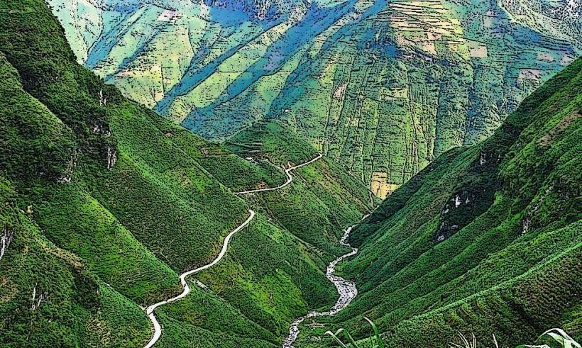
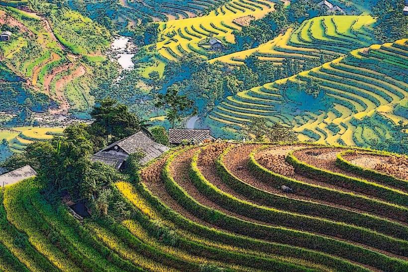
The town is characterized by its mountainous terrain, with structures built into the slopes. Buildings are primarily constructed from concrete and brick, often painted in muted earth tones. The surrounding landscape features steep limestone karsts and terraced rice paddies, with the Nho Que River flowing through the valley below.
Location & Access Logistics
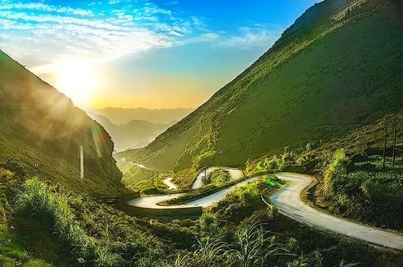
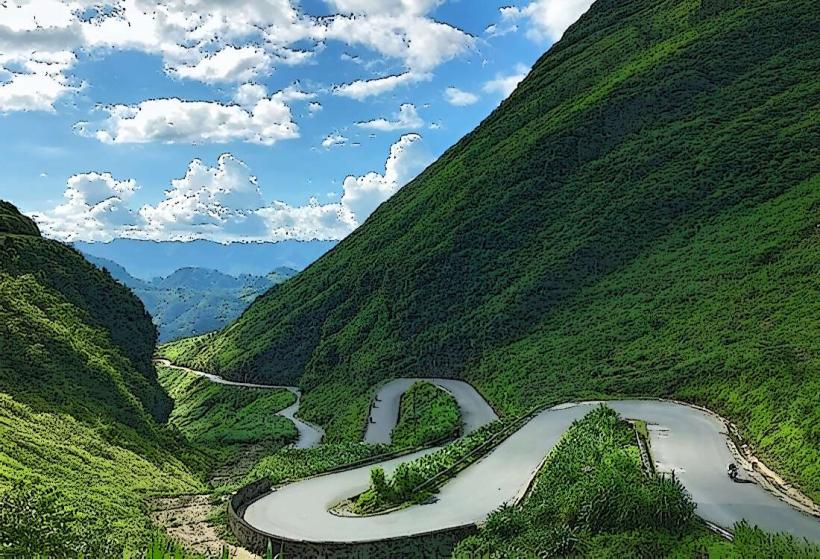
Meo Vac Town is located approximately 160 kilometers northeast of Ha Giang City. Access is primarily via National Highway 4C, a winding mountain road. The journey from Ha Giang City typically takes 4-5 hours by car or motorbike. Limited public bus services operate between Ha Giang City and Meo Vac. Parking is available in designated areas within the town, though it can be limited during peak periods.
Historical & Ecological Origin
Meo Vac Town serves as an administrative and economic center for the Meo Vac District. The region's geological formation is part of the Dong Van Karst Plateau Geopark, a UNESCO Global Geopark, characterized by its unique karst topography shaped by millions of years of geological processes. The area has been inhabited by ethnic minority groups for centuries, with agriculture, particularly rice cultivation, forming the basis of the local economy.
Key Highlights & Activities
Visitors can observe the daily market activities, particularly the weekend ethnic minority markets. Hiking trails are available in the surrounding mountains, offering views of the valley. Boat trips on the Nho Que River are possible, providing a different perspective of the karst formations. The Ma Pi Leng Pass, a scenic mountain pass, is located near Meo Vac Town.
Infrastructure & Amenities
Basic guesthouses and small hotels are available in Meo Vac Town. Local eateries serve Vietnamese cuisine. Restrooms are generally available at accommodations and public market areas. Cell phone signal (2G/3G) is present, though coverage can be inconsistent in outlying areas. Shade is limited in the town center, primarily found under building overhangs.
Best Time to Visit
The dry season, from October to April, offers the most stable weather conditions. For photography, early morning and late afternoon provide optimal lighting for the karst landscapes. The period following the harvest, typically September and October, showcases the golden hues of the rice terraces.
Facts & Legends
The Ma Pi Leng Pass, often referred to as the "King of Passes" in Vietnam, was constructed by over 1,000 young volunteers from 16 ethnic groups over six years. A local legend speaks of a dragon that carved the Nho Que River valley.
Nearby Landmarks
- Ma Pi Leng Pass (1km Northwest)
- Nho Que River (2km South)
- Dong Van Karst Plateau Geopark Visitor Center (15km West)
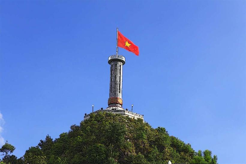
- Lung Cu Flag Tower (30km Northwest)