Information
Landmark: Quan Ba Heaven’s GateCity: Ha Giang
Country: Vietnam
Continent: Asia
Quan Ba Heaven’s Gate, Ha Giang, Vietnam, Asia
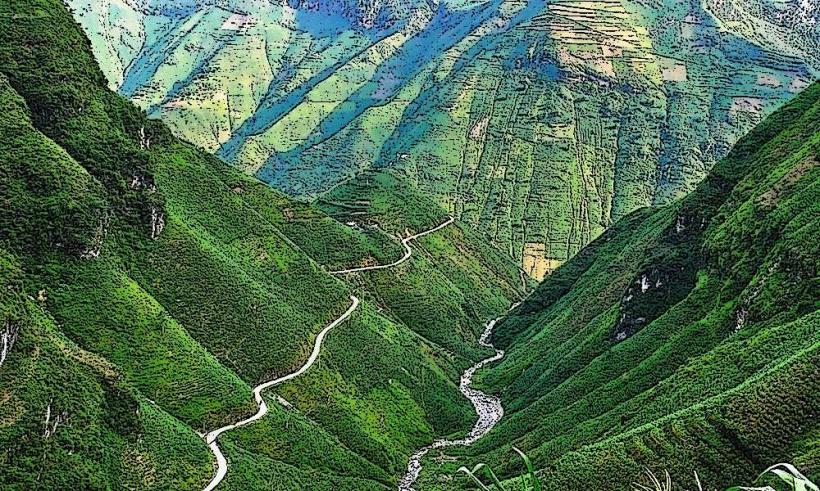
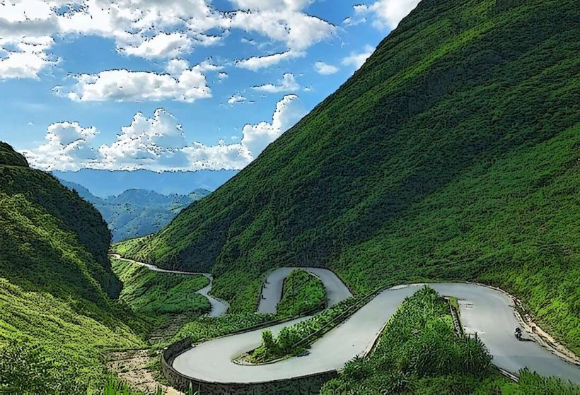
Quan Ba Heaven’s Gate is a mountain pass located in Quan Ba District, Ha Giang Province, Vietnam. It offers panoramic views of the surrounding karst landscape.
Visual Characteristics
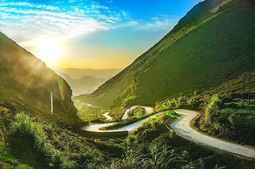
The pass itself is a paved road winding through limestone mountains. The dominant geological features are steep, conical karst peaks covered in dense, green vegetation. The sky is typically blue, with cloud formations varying based on atmospheric conditions. The road surface is asphalt. Elevation at the gate is approximately 1,500 meters above sea level.
Location & Access Logistics
Quan Ba Heaven’s Gate is situated approximately 40 kilometers north of Ha Giang City. Access is via National Highway 4C, also known as the Dong Van Karst Plateau Geopark Road. The journey from Ha Giang City takes approximately 1 hour by car or motorbike. Parking is available at designated pull-off areas near the summit, with capacity for approximately 20 vehicles. Public transport directly to the gate is limited; travelers typically utilize private vehicles or organized tours originating from Ha Giang City.
Historical & Ecological Origin
The geological formation of the Quan Ba Heaven’s Gate area is part of the Dong Van Karst Plateau, a UNESCO Global Geopark. The karst topography was formed over millions of years through the erosion of limestone by water and wind. The specific pass was likely a natural route that was later improved for vehicular access. There is no single architect or construction date for the pass itself, as it evolved from a natural feature.
Key Highlights & Activities
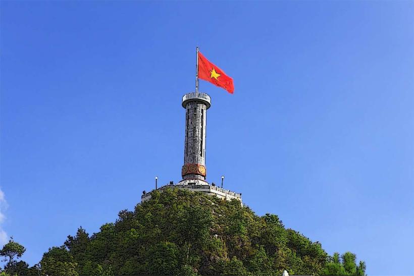
Observation of the Twin Mountains (Nui Doi) from the viewpoint. Photography of the karst landscape. Walking along the paved observation areas. Experiencing the change in temperature due to the elevation.
Infrastructure & Amenities
Restrooms are available at the summit viewpoint. Limited shade is provided by small shelters at the observation points. Cell phone signal (4G) is generally available. Food vendors are present at the summit, offering local snacks and beverages.
Best Time to Visit
For photography, early morning (7:00 AM - 9:00 AM) offers softer light and potential for mist in the valleys. Late afternoon (4:00 PM - 5:30 PM) provides warm, directional light. The dry season, from October to April, generally offers clearer skies and more stable weather. During the rainy season (May to September), cloud cover can obscure views, but the landscape appears greener.
Facts & Legends
A local legend associated with the Twin Mountains visible from the gate tells of a celestial couple. The male mountain is said to represent the father, and the female mountain the mother, watching over the land. Another notable fact is the significant temperature difference often experienced between Ha Giang City and the Heaven's Gate due to the altitude change.
Nearby Landmarks
- Twin Mountains (Nui Doi) - 0.1km South
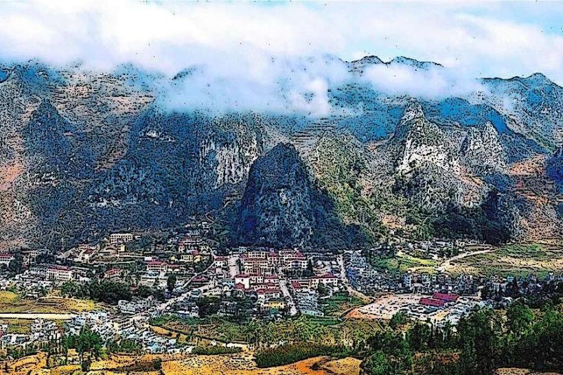
- Quan Ba Town - 5km South
- Lung Tam Village - 10km Northeast
- Dong Van Karst Plateau Geopark Visitor Center - 35km North