Information
City: Viti LevuCountry: Fiji
Continent: Australia
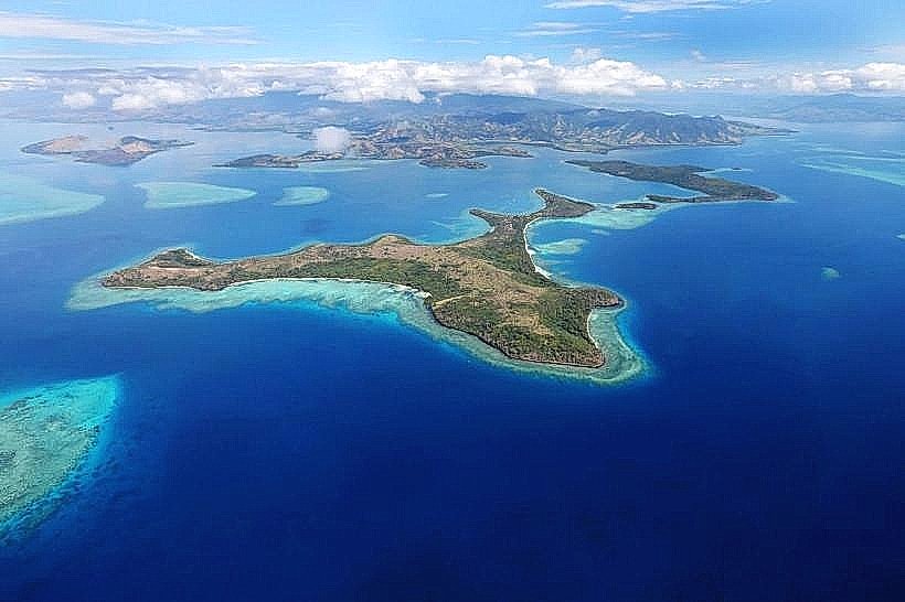
Viti Levu, Fiji, Australia
Viti Levu functions as the primary economic, political, and logistical center of Fiji, containing approximately 75% of the national population. It is the largest island in the archipelago, situated at the center of the Fiji platform and serving as the international gateway for the South Pacific.
Historical Timeline
Viti Levu has been inhabited for over 3,000 years, with the first Lapita settlers arriving at Vuda Point. The modern era of governance was established in 1874 with the signing of the Deed of Cession in Levuka (Ovalau), though the capital was relocated to Suva in 1882 to accommodate urban expansion. A significant economic reconstruction occurred in the late 19th century with the development of the sugar industry on the western plains. The primary event shaping the current urban form was the mid-20th century development of Nadi International Airport and the subsequent sealing of the Queens and Kings Roads, which created a bifurcated economic corridor between the "Burning West" (tourism/sugar) and the "Wet East" (government/commerce).
Demographics & Population
The population is approximately 630,000. The demographic composition is approximately 54% iTaukei, 38% Indo-Fijian, and 8% representing Chinese, European, and other Pacific Islander minorities. The median age is 29.1 years. Approximately 60% of the population resides in urban or peri-urban areas within the Suva-Nausori and Nadi-Lautoka corridors.
Urban Layout & Key Districts
The island is organized around two primary highways: the Queens Road (Southern/Western coast) and the Kings Road (Northern/Eastern coast).
Suva: The capital and primary administrative, educational, and diplomatic hub.
Nadi: The tourism and aviation hub on the western coast.
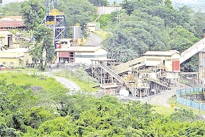
Lautoka: Known as "Sugar City," it is the second-largest city and primary industrial port.
Coral Coast: A 120-km stretch of the southern coast dedicated to high-density resort development.
Sigatoka: The agricultural center known as "Fiji's Salad Bowl."
Top City Landmarks
Fiji Museum (Suva): Located in Thurston Gardens, housing the world's premier collection of Fijian archaeological and cultural artifacts.
Sri Siva Subramaniya Swami Temple (Nadi): The largest Hindu temple in the Southern Hemisphere, noted for its Dravidian architecture.
Sigatoka Sand Dunes: Fiji's first National Park, featuring prehistoric burial sites and dunes up to 60 meters high.
Tavuni Hill Fort: A semi-restored 18th-century Tongan defensive fortification in the Sigatoka Valley.
Navala Village: The last remaining settlement on Viti Levu where all structures are built using traditional bure (thatched) architecture.
Transportation Network
Movement is dictated by the perimeter road system. There is no metro, tram, or rail service. Public transport consists of an extensive network of color-coded buses (e.g., Shorebus, Sunbeam) and a high density of white metered taxis in urban areas. Shared minivans operate as high-speed, informal transit between Suva and Nadi. Ride-sharing is limited to local apps like GoFiji and Fiji Cabs. Traffic congestion is severe in the Suva-Nausori corridor during peak hours.
Safety & "Red Zones"
The overall safety risk is low, but urban centers have specific caution zones. In Suva, the area around the bus station and the waterfront (My Suva Park) should be avoided after midnight. In Nadi, the "Nadi Back Road" and poorly lit industrial areas are higher-risk for opportunistic crime. Common scams include "sword sellers" in Suva and Nadi who attempt to carve names into wooden souvenirs before demanding high payment.
Digital & Financial Infrastructure
Internet speeds in urban centers average 15–30 Mbps via 4G/LTE. Vodafone and Digicel are the primary mobile carriers, while Starlink now provides high-speed satellite coverage in the interior highlands. Card acceptance is universal in cities but cash is required for local markets and rural transport. ATMs are ubiquitous in all major towns.
Climate & Air Quality
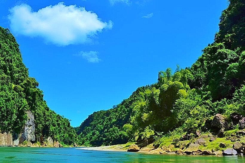
Viti Levu features a sharp climatic divide: the Southeast is a tropical rainforest environment (Suva), while the Northwest is a tropical savanna (Nadi). Daytime temperatures range from 26°C to 33°C. Air quality is generally high, though localized soot occurs near Lautoka during the sugar crushing season. The primary weather risks are tropical cyclones and flash flooding in the Nadi CBD and Navua plains.
Culture & Social Norms
Tipping is not required. Social norms vary between the multicultural urban centers and traditional rural villages. Modest dress (shoulders and knees covered) is required when visiting villages. Public displays of affection are culturally discouraged. The "Kava Circle" remains the primary social and political forum for communal decision-making.
Accommodation Zones
Denarau Island (Nadi): Recommended for high-end logistics and proximity to the Mamanuca ferry terminal.
Suva CBD/Laucala Bay: Recommended for business, diplomatic access, and nightlife.
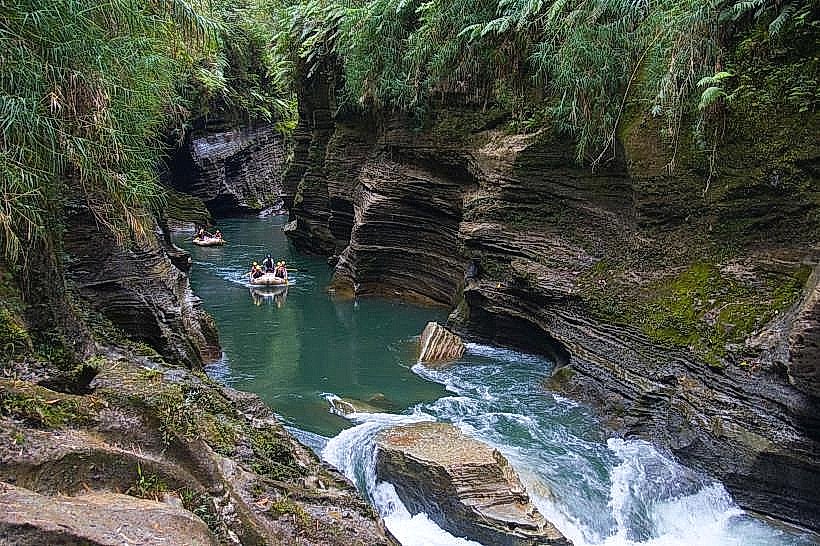
Pacific Harbour: Recommended as the "Adventure Capital" for diving and river rafting.
Local Cost Index
1 Espresso: 7.50 FJD ($3.35 USD)
1 Standard Lunch: 15.00–25.00 FJD ($6.70–$11.15 USD)
1 Inter-city Bus (Nadi-Suva): 20.00 FJD ($8.95 USD)
Nearby Day Trips
Colo-i-Suva Forest Park: A rainforest preserve 15 minutes from Suva.
Garden of the Sleeping Giant: A botanical garden 20 minutes from Nadi.
Robinson Crusoe Island: Accessible via the southwest coast for cultural displays.
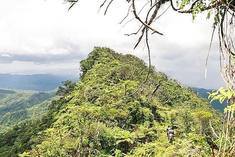
Namosi Highlands: Recommended for off-road interior exploration.
Facts & Legends
Viti Levu is the site of the "Legend of the Seven Sisters," which explains the formation of the volcanic peaks overlooking the western coast. Historically, the island was once partitioned into hundreds of warring independent chiefdoms before the rise of the Cakobau government. A verified historical oddity is that during the American Civil War, Viti Levu became a global center for cotton production due to the blockade of the Southern United States, leading to a temporary "land rush" in the Rewa Valley.