Information
Landmark: Navua RiverCity: Viti Levu
Country: Fiji
Continent: Australia
Navua River, Viti Levu, Fiji, Australia
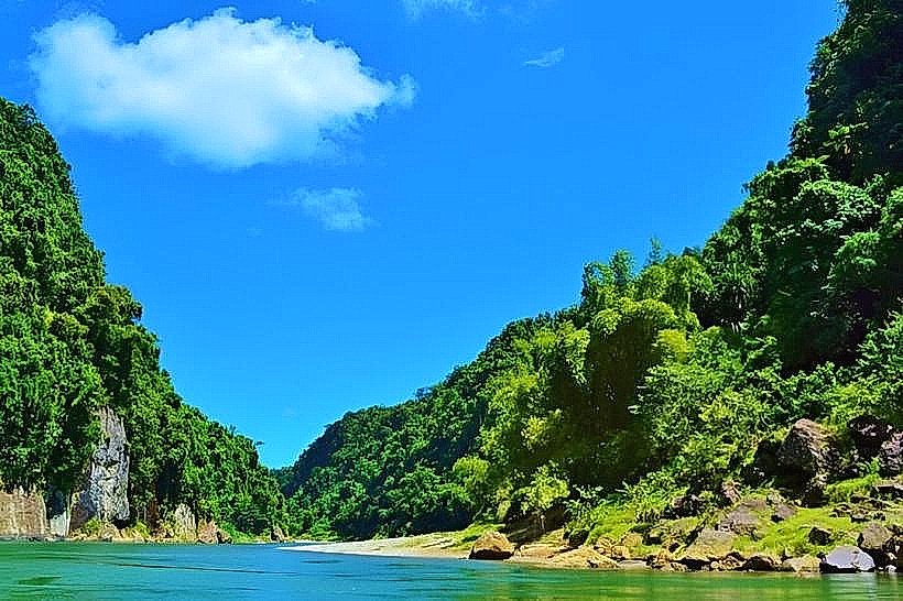
The Navua River is a major waterway on the island of Viti Levu, Fiji, flowing approximately 65 kilometers from the interior highlands to the southern coast. It originates on the slopes of Mount Gordon and discharges into the Beqa Channel near the town of Navua.
Visual Characteristics
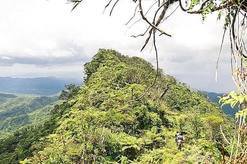
The river is characterized by deep, narrow limestone canyons with vertical walls reaching heights of up to 40 meters. The water color varies from clear emerald in the upper reaches to a sediment-heavy brown near the delta during periods of high rainfall. The riparian zone features dense tropical rainforest, over 50 waterfalls plunging directly into the river channel, and black volcanic rock outcrops covered in ferns and moss.
Location & Access Logistics
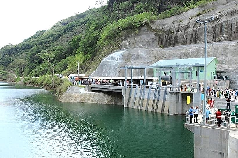
The river is situated 40 kilometers west of Suva. Access to the upper canyon is strictly via organized longboat transfers departing from the Navua town bridge or through 4x4 vehicle tracks via the Namosi Highlands. The lower reaches are accessible via the Queens Road, which crosses the river at the Navua Bridge. Public transport is available via express buses running between Suva and Nadi, stopping at the Navua town junction.
Historical & Ecological Origin
The Navua River runs through a series of geological faults in the Viti Levu interior, carving through volcanic and sedimentary rock layers formed during the Miocene epoch. Historically, the river served as the primary transport artery for the Upper Navua Gorge tribal settlements and later for the transport of sugarcane and timber during the colonial era. The Upper Navua Conservation Area was established to protect the endemic Sago Palm (Metroxylon vitiense) found along its banks.
Key Highlights & Activities
Whitewater rafting and inflatable kayaking take place in the Upper Navua Gorge, primarily navigating Class II and III rapids. Motorized longboat tours provide access to the interior for visits to traditional Fijian villages and the "Magic Waterfall." Bamboo rafting (bilibili) is a traditional transport method still used for eco-tourism excursions in the calmer lower sections.
Infrastructure & Amenities
Infrastructure is limited to the river mouth and specific eco-tourism bases. There are no public restrooms, potable water stations, or food vendors along the upper 30 kilometers of the river. Cell phone signal is non-existent in the canyon depths and becomes sporadic 5 kilometers inland from the coast. Shaded areas are provided by the natural canyon walls and dense forest canopy.
Best Time to Visit
The dry season from May to October is the optimal period for rafting and boat travel, as river levels are stable and water clarity is at its highest. During the wet season (November to April), the river is prone to flash flooding, which frequently results in the suspension of all water-based activities. Mid-morning is the best time for photography to allow sunlight to penetrate the deep canyon floor.
Facts & Legends
The Upper Navua Gorge is recognized as a Ramsar Site, making it a wetland of international importance due to its unique biodiversity. Local legends tell of a giant eel that inhabits the deep pools of the gorge, acting as a guardian for the interior tribes and regulating the flow of water during periods of drought.
Nearby Landmarks
Navua Town - 0.5km South (from river mouth)
Pacific Harbour - 5.0km West
Beqa Island - 15.0km South (offshore)
Namosi Highlands - 4.5km North (upper reaches)