Information
City: Wangdue PhodrangCountry: Bhutan
Continent: Asia
Wangdue Phodrang, Bhutan, Asia
Wangdue Phodrang is the administrative seat of the largest district in Bhutan and a critical transit point connecting western, central, and southern regions. Situated at an elevation of 1,350 meters, it occupies a strategic ridge overlooking the confluence of the Punatsang Chhu and Dang Chhu rivers.
Historical Timeline
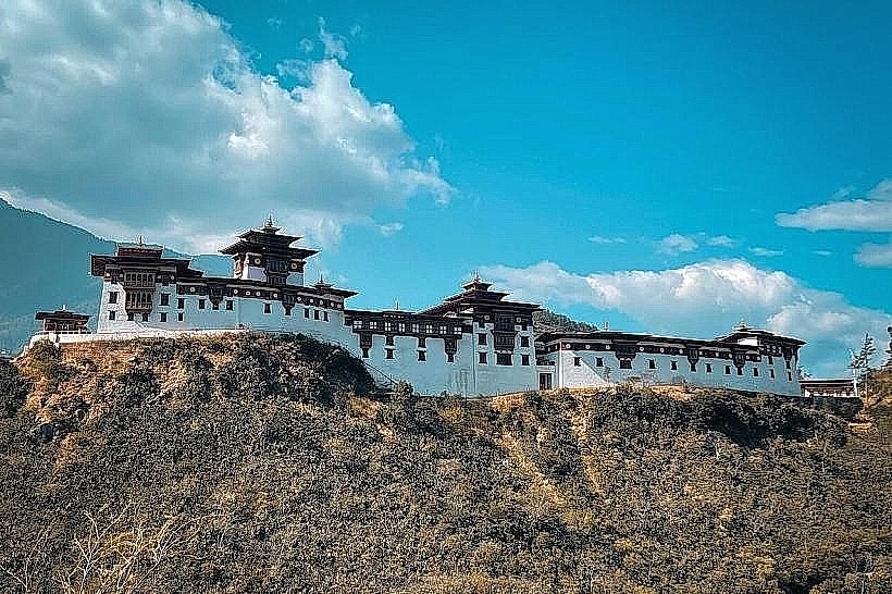
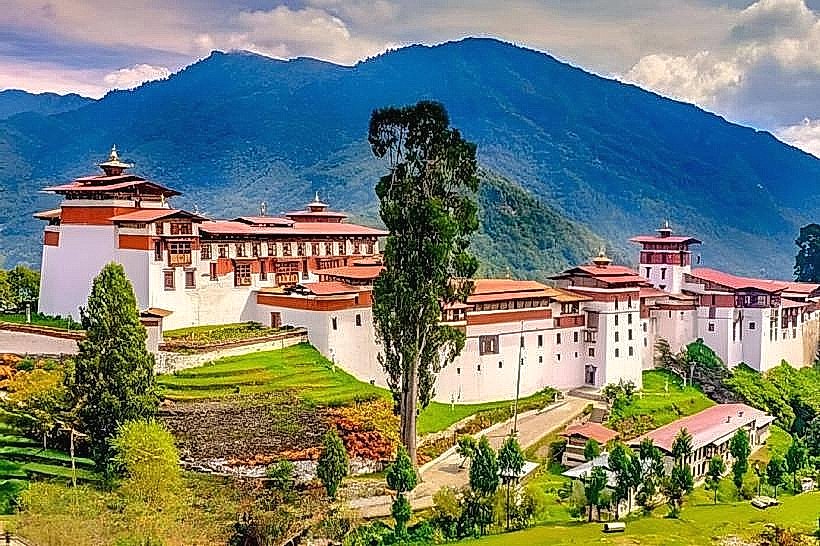
Founded in 1638 by Zhabdrung Ngawang Namgyal, the town was established to unify western Bhutan and secure trade routes against southern invasions. The name "Wangdue" is said to have been given by the Zhabdrung after meeting a boy named Wangdi playing by the river. On June 24, 2012, the historic Wangdue Phodrang Dzong was almost entirely destroyed by an electrical fire. Following a massive decade-long reconstruction project supported by the Government of India, the dzong was fully restored to its original splendor and consecrated in late 2022.
Demographics & Population
The 2026 projected population for the Wangdue Phodrang urban area is 10,500. The district population exceeds 43,000. The demographic is primarily Ngalop, with a diverse mix of ethnic groups due to its role as a cross-country trade hub. The median age is approximately 28 years.
Urban Layout & Key Districts
Khuruthang-Wangdue Corridor: A developing urban stretch that effectively links Wangdue with neighboring Punakha.
The Dzong Ridge: The historical and administrative heart of the town, situated on a spur shaped like a "sleeping elephant."
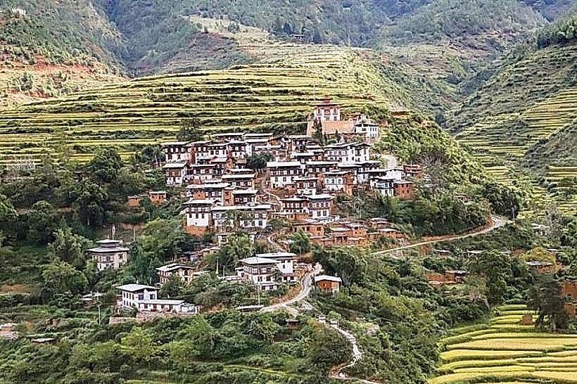
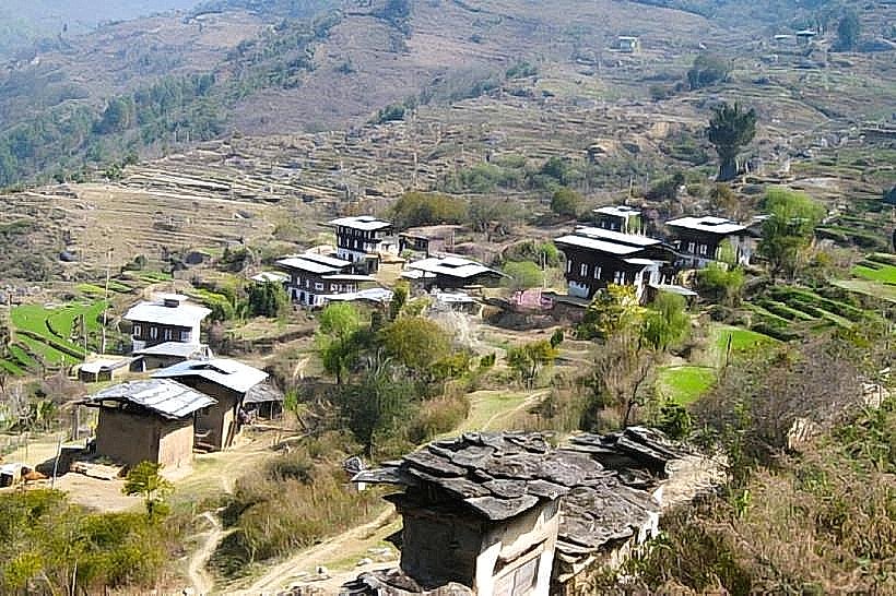
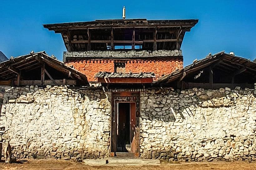
Rinchengang Village: Located directly across the river from the dzong; it is one of Bhutan's oldest heritage villages, known for its terraced stone-masonry houses.
Bajo Town: The modern commercial center of the district, featuring grid-style streets, markets, and regional government offices.
Top City Landmarks
Wangdue Phodrang Dzong: The newly reconstructed 17th-century fortress-monastery; it is the town's most dominant and sacred architectural feature.
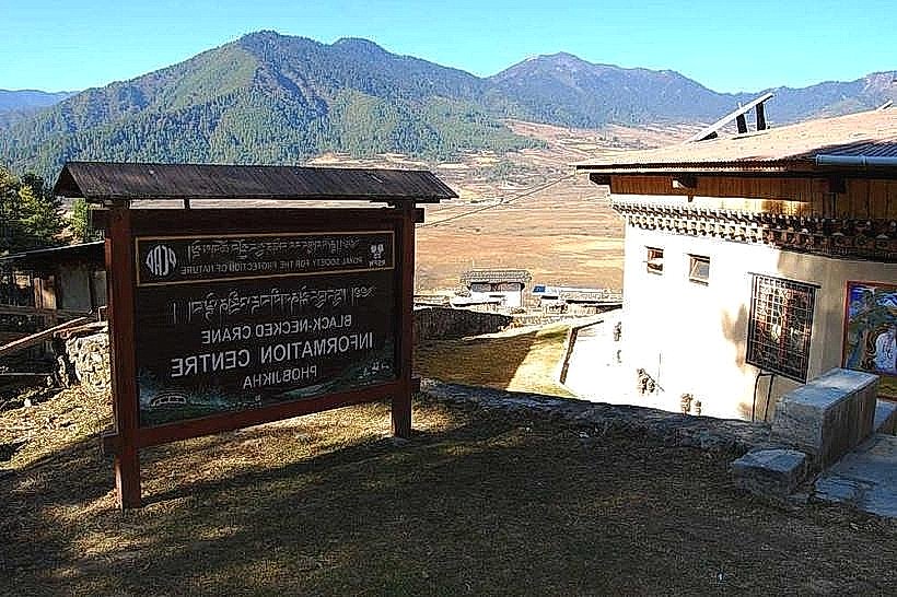
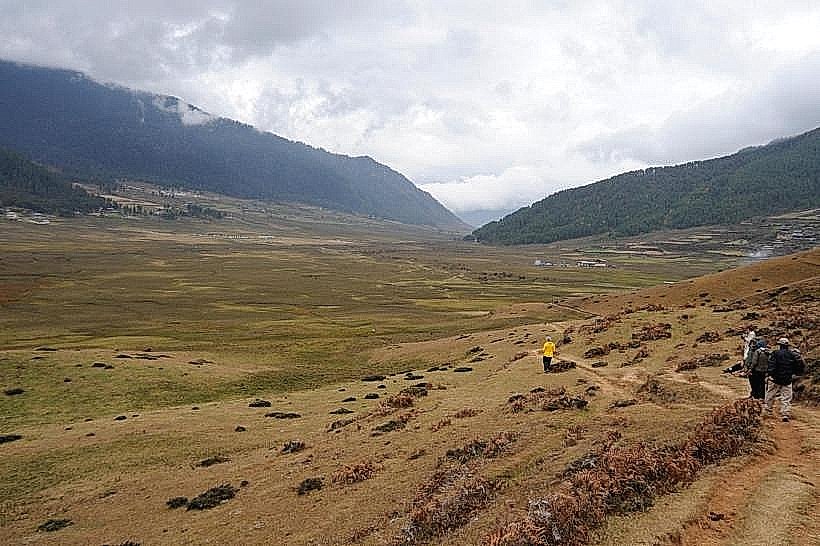
Phobjikha Valley: A high-altitude glacial valley (3,000m) within the district, famous as the winter home of the endangered black-necked cranes.
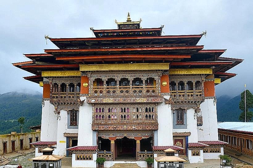
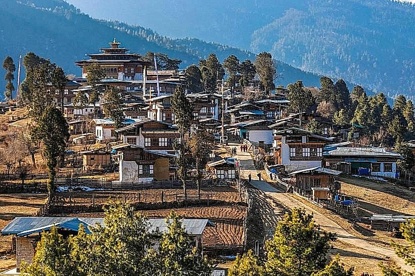
Gangtey Monastery: A 17th-century Nyingma monastery overlooking the Phobjikha Valley.
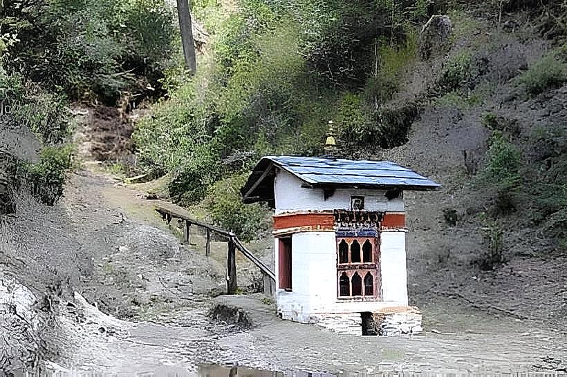
Sha Radap Temple: A revered temple dedicated to the protective deity of the Sha region, where parents bring newborns for blessings.
Pele La Pass (3,420m): The traditional boundary between western and central Bhutan, located 59 km east of the town.
Transportation Network
Movement is facilitated by the East-West National Highway. Wangdue is the last major town before the road climbs into the Black Mountains toward Central Bhutan. There is no rail or metro. The local transport system relies on government-regulated taxis and regional buses. As of 2026, the road network toward Trongsa has seen significant resurfacing, though travelers should expect delays during the monsoon season (June–August) due to potential landslides.
Safety & "Red Zones"
The general safety level is very high. Crime is negligible. There are no political "red zones." The primary risks are environmental: the Punatsang Chhu river basin is a monitored flood risk zone, particularly for Glacial Lake Outburst Floods (GLOF). The steep, winding sections of the highway toward Pele La are considered high-caution areas for drivers during winter snow or summer rains.
Digital & Financial Infrastructure
Average internet speed is 30–50 Mbps, with 4G universal and 5G available in the Bajo Town core as of 2026. Mobile services are provided by Bhutan Telecom and TashiCell. Digital payment via mBOB is standard in Bajo, while cash (Ngultrum) is required in rural villages like Rinchengang. ATMs are located in the Bajo commercial district.
Climate & Air Quality
Temperatures range from 3°C to 17°C in winter (January) and 18°C to 30°C in summer (July). The valley is warmer and windier than Thimphu, earning it the nickname "the windy valley." Air quality is "Excellent" (AQI < 25), though winter forest fires in the surrounding hills can occasionally cause temporary "Moderate" spikes in particulate matter.
Culture & Social Norms
The standard tipping rate is $10–$15 USD per day for trekking and tour staff. As of 2026, the Sustainable Development Fee (SDF) is $100 USD per night, plus a 5% GST on tour services. The local culture is famous for Lozeys (ornamental speeches or ballads). Modest dress (covering shoulders and knees) is strictly required for entry into the dzong and all religious sites.
Accommodation Zones
Bajo Town: Stay here for modern hotels, restaurants, and ease of transit.
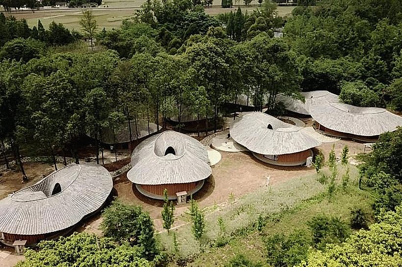
Phobjikha Valley: Stay in eco-lodges or farmstays for crane-watching and high-altitude hiking.
Local Cost Index
1 Espresso: 260 Nu ($3.15)
1 Standard Lunch: 600 Nu ($7.25)
1 Taxi (Bajo to Dzong): 150 Nu ($1.80)
Nearby Day Trips
Punakha: (21 km - Former capital and site of the Punakha Dzong)
Chimi Lhakhang: (15 km - The "Fertility Temple")
Adha and Rukha Villages: (Remote southern villages accessible by 4WD for authentic homestays)
Facts & Legends
Legend says the Zhabdrung chose the dzong's site after seeing four ravens fly in four different directions, an auspicious sign of the kingdom's future unification. A verified historical oddity is that the residents of Rinchengang are descendants of Indian masons brought to the valley in the 17th century specifically to build the original dzong. In 2026, the newly installed Serto (golden pinnacle) on the dzong's central tower is one of the largest and most intricate in the country.