Information
Landmark: Itakhola MuraCity: Comilla
Country: Bangladesh
Continent: Asia
Itakhola Mura, Comilla, Bangladesh, Asia
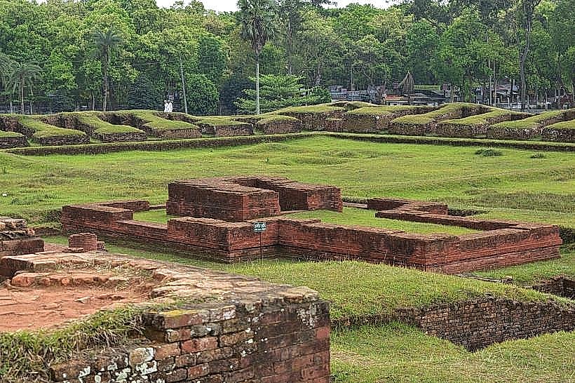
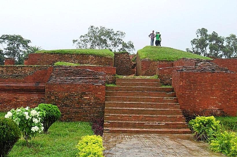
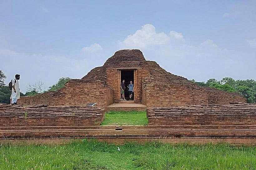
Itakhola Mura is an archaeological site located in the Comilla district of Bangladesh. It is a mound containing remnants of ancient structures.
Visual Characteristics
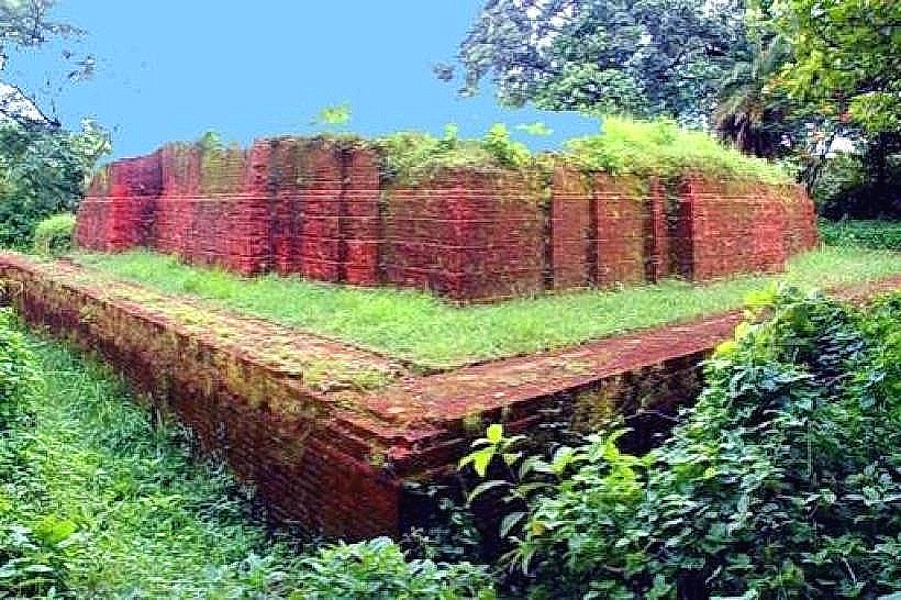
The site is characterized by a raised earthen mound, approximately 10 meters in height. The surface is covered with vegetation, primarily grass and scattered trees. Exposed sections of brickwork, indicative of ancient construction, are visible in certain areas.
Location & Access Logistics
Itakhola Mura is situated approximately 5 kilometers north of the Comilla city center. Access is via the Comilla-Sylhet Highway (N2). Turn west onto the local road signposted for Itakhola. Parking is available on the unpaved area adjacent to the site. No public transport directly serves the immediate vicinity; local auto-rickshaws or private vehicles are the primary means of access from Comilla town.
Historical & Ecological Origin
The mound is believed to be the remains of a Buddhist monastery or temple complex dating back to the Gupta or Pala period (approximately 7th-8th century CE). Archaeological excavations have revealed brick foundations, pottery shards, and terracotta plaques. The site's formation is anthropogenic, resulting from the accumulation of debris over centuries of occupation and subsequent abandonment.
Key Highlights & Activities
Exploration of the exposed brick structures. Observation of archaeological excavation areas. Photography of the mound and surrounding landscape. Visitors can walk around the perimeter of the mound.
Infrastructure & Amenities
No permanent infrastructure or amenities are present at Itakhola Mura. There are no restrooms, designated shade structures, or food vendors. Cell phone signal (4G/5G) is generally available in the area.
Best Time to Visit
The best time for photography is during the early morning or late afternoon when sunlight provides directional illumination. The dry season, from October to March, offers the most comfortable weather conditions for visiting.
Facts & Legends
Local folklore suggests that the mound was once a fort or a royal residence, though archaeological evidence points to a religious or monastic purpose. A unique tip for visitors is to look for small, intricately carved brick fragments that are sometimes found on the surface after rainfall.
Nearby Landmarks
- Lalmai Hill (2.5km South)
- Mainamati Museum (4.0km South)
- Kutila Mura (4.5km South)
- Shalban Bihar (5.0km South)