Information
Landmark: Pulau UbinCity: Eastern Region
Country: Singapore
Continent: Asia
Pulau Ubin, Eastern Region, Singapore, Asia
Pulau Ubin is a granite island located off Singapore's northeastern coast. It serves as a preserved example of Singapore's past kampong (village) life.
Visual Characteristics
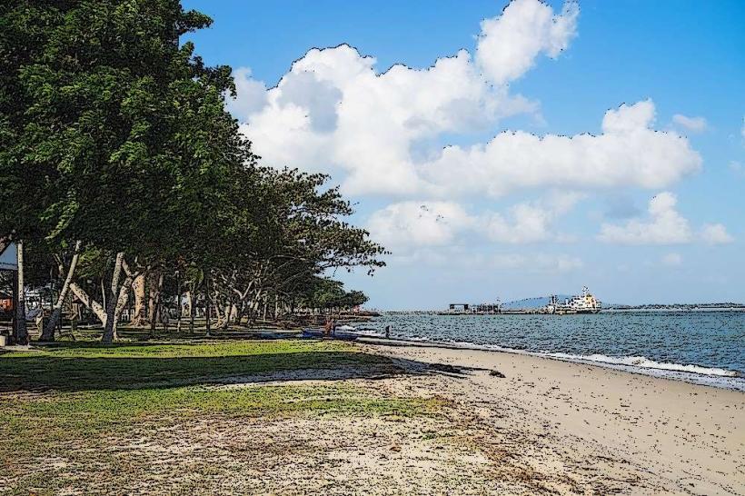
The island is characterized by undulating terrain with granite quarries, mangrove swamps, and secondary forests. Vegetation is dense, featuring a mix of native trees, palms, and coastal shrubs. The coastline consists of mudflats and small beaches. The highest point is Bukit Puaka at 74 meters.
Location & Access Logistics
Pulau Ubin is accessible via a 15-minute bumboat ride from the Changi Point Ferry Terminal. The terminal is located at 31, Changi Village Road, Singapore 509925. Bumboats operate daily from approximately 6:00 AM to 7:00 PM, departing when at least 12 passengers are present. The cost is S$4 per person per way. No specific bus lines directly serve the ferry terminal; visitors typically use bus services to reach Changi Village and then walk to the terminal. Parking is available at the Changi Village carpark, which has a fee.
Historical & Ecological Origin
The island's name, Pulau Ubin, translates to "Granite Island" in Malay, reflecting its historical granite quarrying industry. Quarrying operations began in the late 19th century and continued until the 1970s. The island's ecosystem is a mosaic of secondary rainforest, mangrove, and coastal habitats, supporting diverse flora and fauna.
Key Highlights & Activities
Visitors can rent bicycles at the jetty to explore the island's trails. Activities include birdwatching, observing wildlife such as macaques and wild boars, and exploring the Chek Jawa Wetlands. Kayaking and fishing are also possible. Guided nature walks are available through various operators.
Infrastructure & Amenities
Basic amenities are available near the main jetty, including food stalls selling local dishes and drinks. Restrooms are located at the jetty area and at key points like Chek Jawa Wetlands. Shade is provided by trees and some shelters. Cell phone signal (4G) is generally available but can be intermittent in denser forested areas.
Best Time to Visit
The best time for visiting is during the drier months, from March to September. For photography, early morning or late afternoon offers softer light. High tide is recommended for observing marine life at Chek Jawa Wetlands, typically occurring around the new moon and full moon periods. Low tide exposes the intertidal zone.
Facts & Legends
A local legend suggests that Pulau Ubin was formed when a group of Singaporean villagers challenged a rhinoceros, elephant, and hippopotamus to a race to Singapore Island. The first to reach the island would be granted their wish. The three animals agreed, but the rhinoceros, unable to keep up, was turned into Pulau Ubin.
Nearby Landmarks
- Changi Chapel and Museum (2.5km Southeast)
- Changi Beach Park (3.0km Southeast)
- Johor Bahru, Malaysia (approximately 10km North across the Johor Strait)
- Pasir Ris Park (4.5km Southwest)