Information
City: DonegalCountry: Ireland
Continent: Europe
Donegal, Ireland, Europe
Donegal Town functions as a primary heritage and tourism gateway for Northwest Ireland, situated at the mouth of the River Eske and the head of Donegal Bay. It serves as a logistical hub for the southern part of County Donegal and is the primary center for the production of hand-woven Donegal Tweed.
Historical Timeline
Donegal was established as a Viking fortification in the 9th century (Dún na nGall, "Fort of the Foreigners"). The primary era of governance began in the 15th century under the O’Donnell Clan, one of the most powerful Gaelic families in Ireland. The primary event shaping the town’s decline and subsequent resettlement was the 1607 Flight of the Earls, which saw the end of Gaelic sovereignty and led to the town's reorganization under English Captain Basil Brooke.
Demographics & Population
The population of the town is approximately 2,800. The demographic profile is predominantly Irish, with a stable population involved in agriculture, textiles, and tourism. The median age is 41.3 years.
Urban Layout & Key Districts
The town is organized around a central triangular market square.
The Diamond: The commercial and social heart of the town, featuring retail, traditional pubs, and hotels.
The Quay: A riverside area south of the Diamond providing maritime access and scenic walkways.
Bank Walk: A specialized forested walking trail along the western shore of the Eske estuary.
Glebe: A residential and agricultural district on the northern outskirts.
Top City Landmarks
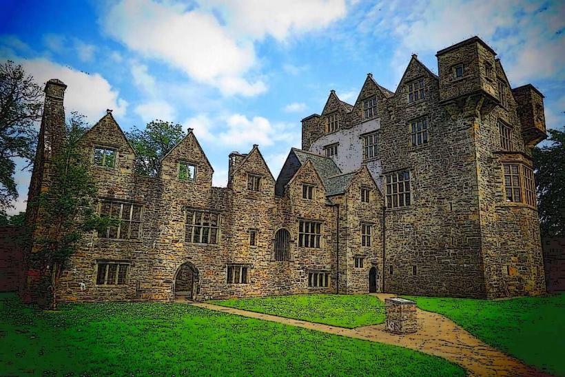
Donegal Castle: A 15th-century tower house built by the O'Donnells and later expanded with a Jacobean wing by the Brooke family.
Donegal Abbey: Ruins of a 15th-century Franciscan friary where the "Annals of the Four Masters" were largely compiled.
The Diamond: The historic town square containing the Four Masters Obelisk.
Magee of Donegal: The historic retail center for Donegal Tweed, operating since 1866.
Donegal Bay Waterbus: Ireland's largest swivel-mast ferry, providing guided tours of the bay’s seal colonies and islands.
Transportation Network
Movement within the town is primarily pedestrian. Public transit consists of regional bus links operated by Bus Éireann and private operators (e.g., Feda O'Donnell), providing transit to Sligo, Derry, and Dublin. There is no rail service; the nearest train station is in Sligo (65 km south). Taxis are available at the Diamond. Traffic is heavy during summer peak months due to its position on the N15/N56 interchange.
Safety & "Red Zones"
The general safety level is very high. Crime is negligible. There are no "red zones." The town is communal and well-lit. Caution is advised only on the shoreline during high tides and in the late hours during weekend nightlife on the Diamond.
Digital & Financial Infrastructure
Internet speeds average 100–500 Mbps via fiber. 5G and 4G coverage is consistent in the town center. Card acceptance is universal in retail and dining. Multibanco-equivalent ATMs are located on the Diamond (Bank of Ireland, AIB).
Climate & Air Quality
Donegal has a maritime temperate climate characterized by high wind speeds and frequent Atlantic rainfall. Daytime temperatures range from 7°C in January to 18°C in July. Air quality is pristine.
Culture & Social Norms
The town is a center for Gaelic cultural heritage. Tipping is customary in restaurants (10%) but not expected at the bar. Traditional music (trad) is a staple of the social scene, specifically at the Reel Inn. Donegal residents possess a distinct regional accent and a strong sense of independence from the eastern centers of power.
Accommodation Zones
The Diamond: Recommended for immediate access to historical sites and nightlife.
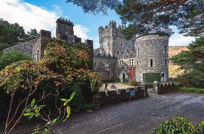
Lough Eske: 6 km northeast; recommended for luxury castle hotel stays and mountain views.
Local Cost Index
1 Espresso: €2.90 ($3.15 USD)
1 Pint of Stout: €5.50–€6.20 ($6.00–$6.75 USD)
1 Standard Lunch: €12.00–€16.00 ($13.00–$17.40 USD)
Nearby Day Trips
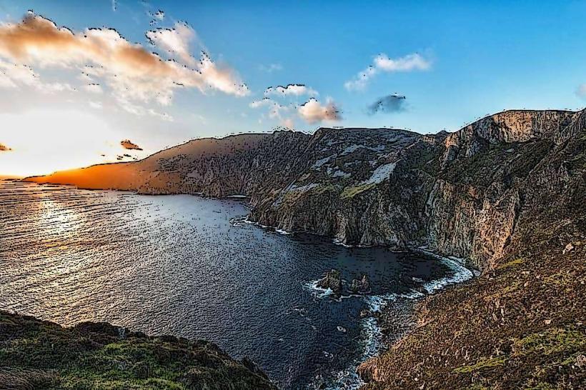
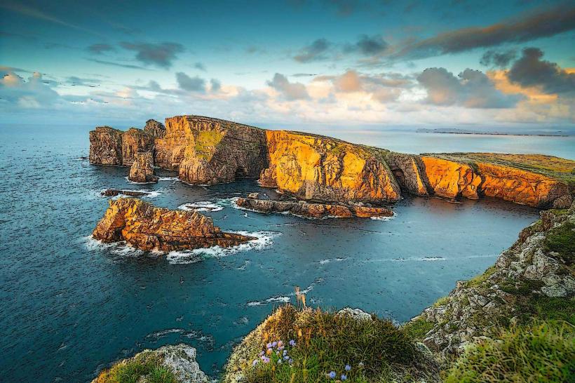
Slieve League (Sliabh Liag): Some of the highest sea cliffs in Europe, 50 km west.
Killybegs: Ireland's premier deep-sea fishing port, 25 km west.
Rossnowlagh Beach: A major surfing and walking beach, 15 km south.
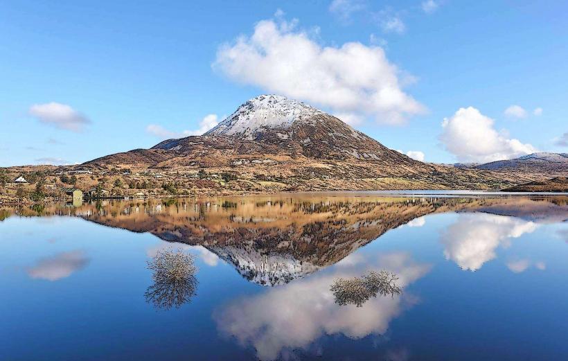
Lough Eske: A scenic lake at the foot of the Blue Stack Mountains.
Facts & Legends
Donegal is the site of the compilation of the Annals of the Four Masters, the primary historical record of medieval Ireland. Historically, Donegal Tweed was dyed using local lichens and mosses to mirror the colors of the landscape. A local legend states that the O'Donnell clan hid a massive treasure in the caves beneath the castle before they fled to Europe in 1607, a treasure that remains undiscovered.