Information
Landmark: Donegal BayCity: Donegal
Country: Ireland
Continent: Europe
Donegal Bay, Donegal, Ireland, Europe
Donegal Bay is the largest bay in Ireland, situated on the northwest coast. It is bordered by the counties of Donegal to the north and east, and Leitrim and Sligo to the south.
Visual Characteristics
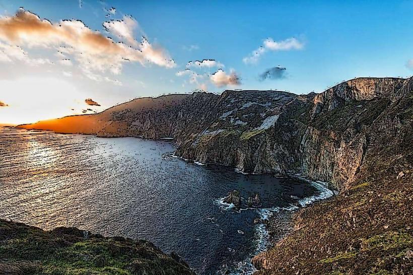
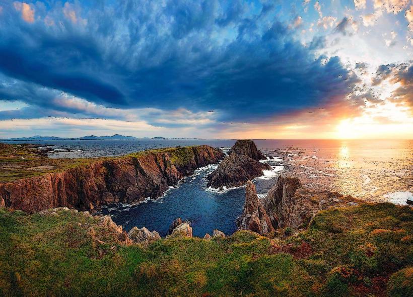
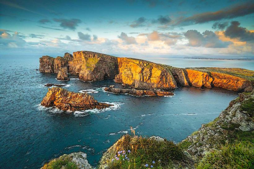
The bay is defined by high-contrast coastal geography, ranging from the massive $601$-meter cliffs of Slieve League to the extensive sandy beaches of Murvagh and Rossnowlagh.
The Estuary: The River Eske enters the bay at Donegal Town, creating a sheltered inner harbor.
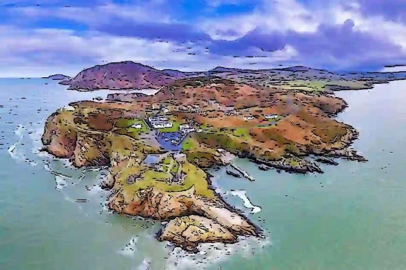
Islands: The inner bay contains a "drowned drumlin" landscape, a cluster of small, verdant limestone islands.
Seascape: The outer bay is open to the North Atlantic, producing high-energy swells and deep-water marine environments.
Location & Access Logistics
Primary Hubs: Donegal Town (East), Killybegs (North), Ballyshannon (South), and Bundoran (South).
Transit: The N56 road skirts the northern edge, while the N15 runs along the eastern and southern perimeters.
Parking: Ample public parking is available at all major coastal towns and blue-flag beaches.
Accessibility: Harbors and town piers (Donegal Town, Killybegs) are fully accessible. Access to the outer cliffs (Slieve League) requires traversing steep terrain.
Historical & Economic Significance
Maritime Hub: Killybegs is Ireland’s premier deep-sea fishing port and a major processing center for North Atlantic pelagic fish.
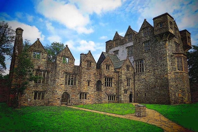
The O'Donnell Dynasty: Historically controlled from Donegal Castle, the bay provided strategic access for trade and defense for the Chieftains of Tyrconnell.
Inis Saimer: A small island in the Erne Estuary at Ballyshannon, legendary as the first place where humans landed in Ireland.
Key Highlights & Activities
Donegal Bay Waterbus: A 75-seat tourist vessel operating from Donegal Town pier; it provides guided tours of the inner bay’s seal colonies and historical sites.
Surfing: The southern reach of the bay (Bundoran and Rossnowlagh) is internationally recognized as a high-performance surfing zone due to consistent Atlantic swells.
Deep-Sea Angling: Charter boats operate out of Killybegs and Teelin for bluefin tuna (catch and release), shark, and cod.
Beach Recreation: Rossnowlagh and Murvagh are expansive beaches suitable for walking and kite-surfing.
Infrastructure & Amenities
Connectivity: Consistent 4G/5G in the main towns; signal drops significantly along the isolated cliffs of the northern shore.
Sanitation: Public restrooms are available at all blue-flag beaches and town piers.
Accommodation: High density of hotels and guest houses in Donegal Town and Bundoran.
Best Time to Visit
Seasonality: June to September for water-based activities.
Weather: Subject to the "North Atlantic Drift," leading to high humidity and frequent rainfall. Maritime fog is common in the outer bay.
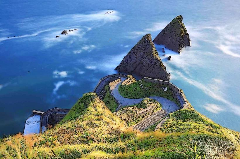
Photography: The viewpoint at Bunglass (Slieve League) offers the best perspective of the bay's scale.
Facts & Legends
A verified technical detail: The bay's inner islands are "drumlins" created by glacial action during the last Ice Age; as sea levels rose, the valleys between these hills flooded, leaving only the summits as islands. Legend holds that the bay was once the haunt of the "Sea-Swallow," a mythical bird that could predict Atlantic storms.
Nearby Landmarks
Slieve League Cliffs – Northwest edge
Donegal Castle – Eastern inner point
Mullaghmore Head – Southern entry point (Sligo)
Killybegs Harbour – Northern shore
Rossnowlagh Beach – Southeastern shore