Information
Landmark: Tory IslandCity: Donegal
Country: Ireland
Continent: Europe
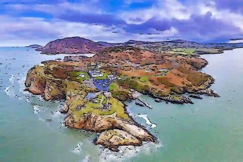
Tory Island, Donegal, Ireland, Europe
Tory Island (Oileán Thoraí) is an offshore island located 14.5km off the northwest coast of County Donegal. It is the most remote inhabited island in Ireland and remains a significant Irish-speaking (Gaeltacht) stronghold.
Visual Characteristics
The island is approximately 5km long and 1km wide.
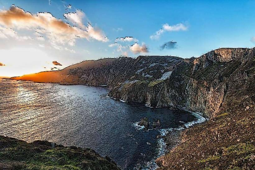
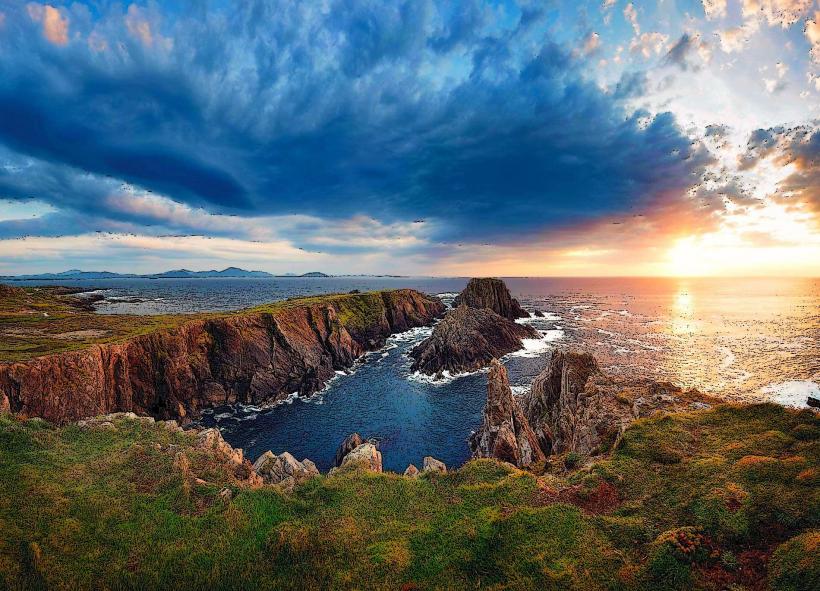
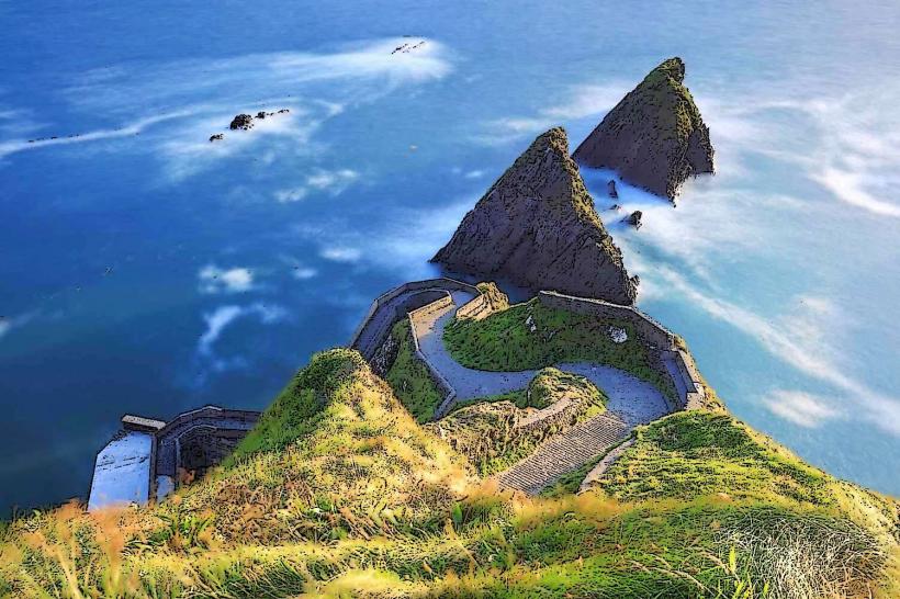
The East: Dominated by dramatic, jagged cliffs and sea stacks, including the iconic "An Tormór."
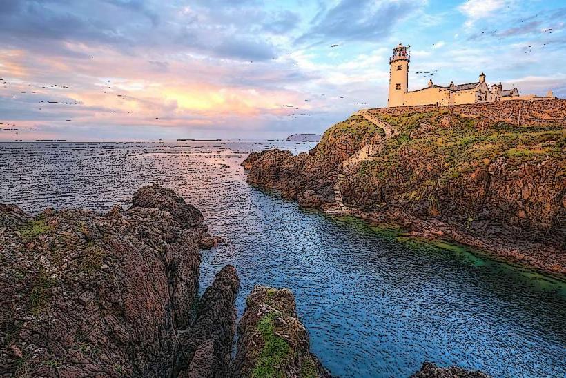
The West: Lower-lying, featuring the island's main settlements and the lighthouse.
Flora/Fauna: Sparse vegetation due to extreme salt spray. It is one of the few remaining habitats for the rare Corncrake.
Location & Access Logistics
Access: Accessible only by ferry.
Ferry Points: Operates daily from Magheroarty (year-round) and Bunbeg (seasonal). The crossing takes approximately 45–60 minutes.
Transit: No cars are brought onto the island by visitors; the island is traversed on foot or by bicycle.
Weather Dependency: Ferries are frequently cancelled during Atlantic gales. Travelers must monitor maritime forecasts.
Historical & Cultural Origin
The King of Tory: The island maintains a unique tradition of electing a "King" (Rí Thoraí), who acts as a cultural ambassador and greets visitors at the pier.
Monastic History: Site of a 6th-century monastery founded by St. Colmcille. Remains include a unique Tau Cross (T-shaped), one of only two in Ireland.
Tory Island School of Painters: A world-renowned primitive art movement started in the 1960s by James Dixon and Derek Hill.
Key Highlights & Activities
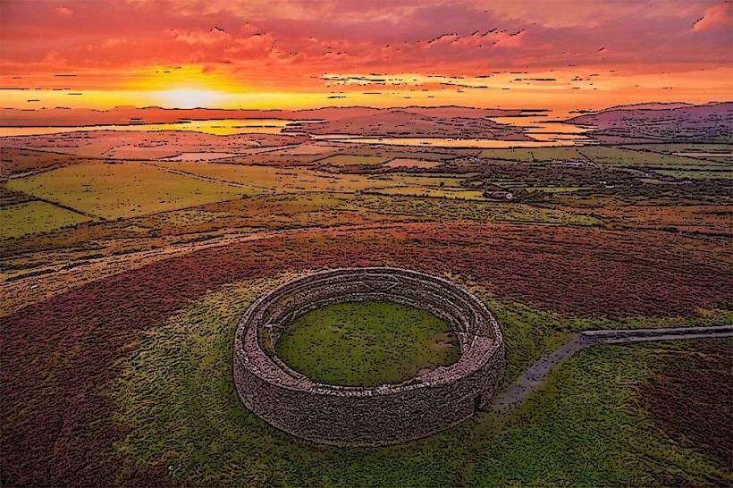
The Round Tower: A 6th or 7th-century bell tower built of granite, used as a refuge during Viking raids.
An Tormór: A massive sea stack at the eastern end, popular with experienced rock climbers.
Balor’s Fort (Dún Bhaloir): A naturally fortified peninsula on the eastern cliffs, linked to the mythological Fomorian king, Balor of the Evil Eye.
Traditional Sessions: Nightly music and dance at the island’s social club (Club Sóisialta Thoraí).
Infrastructure & Amenities
Commercial: One grocery store, a post office, and a small craft shop.
Accommodation: A hotel (Óstán Thoraí) and several bed-and-breakfasts.
Sanitation: Public facilities are available at the pier and within local establishments.
Connectivity: 4G signal is available but can be unstable during heavy weather; Wi-Fi is standard in the hotel and social club.
Best Time to Visit
Seasonality: May to September for reliable ferry crossings and birdwatching.
Photography: The eastern cliffs provide high-contrast maritime scenery, especially during sunrise or high-swell conditions.
Facts & Legends
A verified technical detail: The island's Tau Cross is carved from a single block of mica schist and is associated with seafaring protection. Legend holds that Tory was the stronghold of the Fomorians, a race of giants in Irish mythology, and that the island's soil is "cursed" against rats-no rats exist on the island.
Nearby Landmarks
Magheroarty Beach – 14.5km South (Ferry point)
Bloody Foreland – 12km Southeast
Inishbofin Island – 8km Southeast
Horn Head – 20km East (Visible from cliffs)