Information
Landmark: Dalton HighwayCity: Fairbanks
Country: USA Alaska
Continent: North America
Dalton Highway, Fairbanks, USA Alaska, North America
The Dalton Highway, officially known as Alaska Route 11, is one of North America’s most remote and legendary roads-an unforgiving, 414-mile wilderness corridor that runs from Livengood (north of Fairbanks) to Deadhorse near Prudhoe Bay, within striking distance of the Arctic Ocean. Built in the 1970s to support the construction of the Trans-Alaska Pipeline, this route is both an engineering marvel and a pilgrimage for adventurous travelers seeking to cross the Arctic Circle by land.
The experience is raw and unfiltered-no billboards, no traffic lights, often no cell signal-just tundra, boreal forest, endless sky, and the silver ribbon of the pipeline following the road’s contour through mountains and permafrost plains.
Historical Background
The Dalton Highway was constructed in 1974, named after James W. Dalton, an Alaskan engineer and Arctic logistics expert. Its original purpose was purely industrial: to serve as a service road for the Trans-Alaska Pipeline and provide a transport route to the Prudhoe Bay oil fields. Over time, it became a symbol of isolation and endurance, attracting truckers, researchers, and a growing number of tourists fascinated by its desolate grandeur.
Even today, the Dalton remains a lifeline for Alaska’s northern oil industry and one of the most challenging public roads in the United States-mostly gravel, often rough, and punctuated by weather extremes.
Route and Geography
From Fairbanks to Deadhorse, the Dalton crosses a dramatic cross-section of Alaska’s natural environments:
Mile 0 – Livengood: The official start of the Dalton, where paved roads give way to gravel.
Mile 56 – Yukon River Bridge: A sweeping steel bridge over the Yukon River, with a small outpost offering fuel, coffee, and the first glimpse of the Trans-Alaska Pipeline.
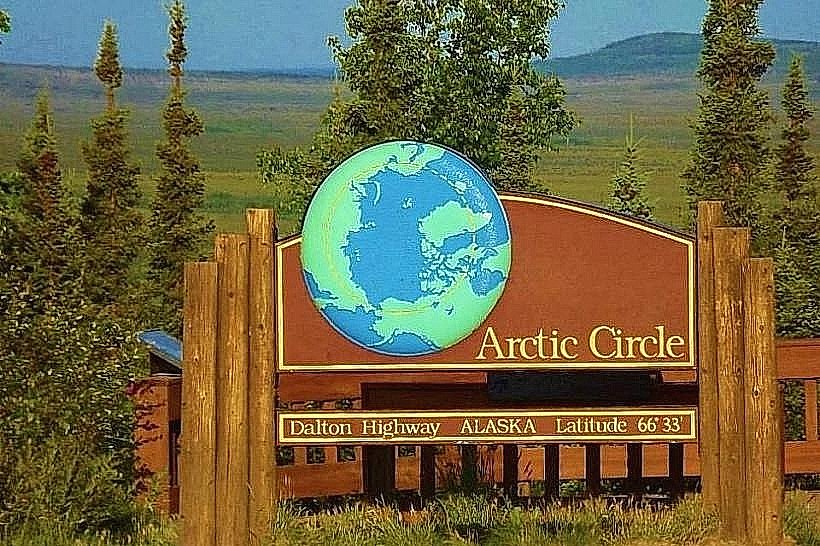
Mile 115 – Arctic Circle Sign: The iconic wooden marker where travelers can officially stand at latitude 66°33′ north, the southernmost point of the Arctic region. It’s a popular photo stop and milestone achievement for many.
Mile 175 – Coldfoot: A former construction camp turned truck stop, home to a café, small visitor center, and the northernmost hotel accessible by road year-round.
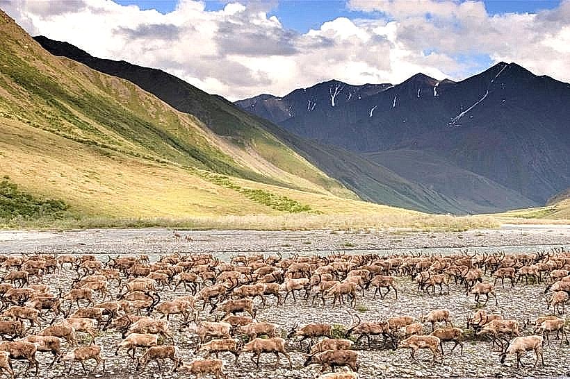
Mile 244 – Atigun Pass: At 4,739 feet, this is the highest year-round highway pass in Alaska, cutting through the Brooks Range with striking views of rocky spires and caribou herds.
Mile 414 – Deadhorse/Prudhoe Bay: The terminus of the road, beyond which lies the Arctic Ocean, accessible only through guided tours due to oilfield security restrictions.
The Arctic Circle Crossing
The Arctic Circle sign at Mile 115 marks one of the most symbolic points on the Dalton Highway. Crossing it means entering a latitude where the midnight sun shines continuously in summer and the polar night dominates winter. In June, visitors can stand beneath a glowing sky at midnight, while in December, the same location sits in deep twilight.
Nearby pullouts allow travelers to rest, photograph the landscape, and soak in the solitude-boreal forest stretching for miles, the pipeline gleaming in the distance, and the faint hum of wind over gravel.
Wildlife and Landscape
The Dalton Highway traverses some of Alaska’s most varied ecosystems:
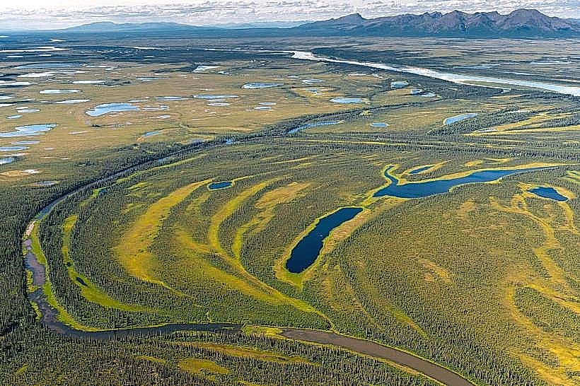
Taiga Forests: South of the Arctic Circle, spruce and birch dominate the gently rolling hills.
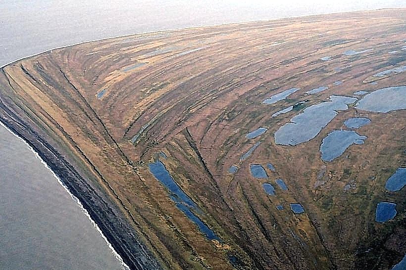
Tundra and Permafrost Plains: North of Coldfoot, the landscape opens into treeless tundra carpeted with moss, lichen, and dwarf shrubs.
Brooks Range Mountains: Towering granite peaks frame narrow valleys where Dall sheep, musk oxen, and arctic foxes roam.
Migrating Caribou: Massive herds cross the highway during seasonal migrations, a reminder of the region’s untamed rhythm.
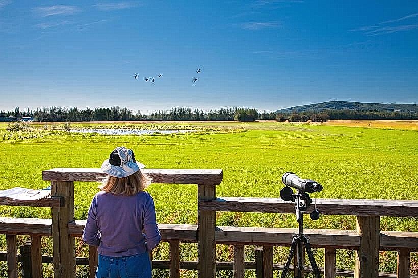
Birdlife: In summer, loons, sandpipers, and snowy owls fill the air with movement and sound, especially near wetland areas.
Visitor Experience
Driving the Dalton is not a casual day trip-it’s an expedition. There are no services for hundreds of miles, and conditions can shift from sun to snow within hours. Yet for those prepared, it’s a journey of pure freedom.
Road Surface: Mostly gravel with occasional paved sections. Dusty when dry, slippery when wet.
Best Season: Late May to early September; summer offers the midnight sun and clear mountain passes.
Facilities: Sparse-gas stations at Yukon River, Coldfoot, and Deadhorse. Travelers must carry extra fuel, food, and emergency gear.
Guided Tours: For those without 4WD vehicles or Arctic driving experience, several operators in Fairbanks offer guided excursions to the Arctic Circle sign or beyond to Coldfoot.
Atmosphere and Impressions
The Dalton Highway feels like a moving meditation through space and silence. The road hums beneath your tires, the pipeline glints beside you, and the horizon seems to retreat endlessly. Truckers wave as they pass, their rigs raising plumes of dust. In the stillness, the vastness of Alaska unfolds-a land shaped by ice, wind, and solitude.
At the Arctic Circle, time seems suspended. The air is sharp and pure; the light, silvery and unbroken. Standing at that latitude, surrounded by wilderness, one feels both insignificant and infinite-a fleeting traveler in a land that belongs to no one but itself.
Legacy
The Dalton Highway and Arctic Circle crossing remain among the great overland adventures of North America. Beyond its industrial origins, the route has become a symbol of Alaska’s scale and isolation, where wilderness still rules and human presence is temporary. For those who complete the journey, it offers not just a destination but a transformation-a rare glimpse into the raw, unbounded north.