Information
Landmark: Parque Tayrona BeachesCity: Santa Marta
Country: Colombia
Continent: South America
Parque Tayrona Beaches, Santa Marta, Colombia, South America
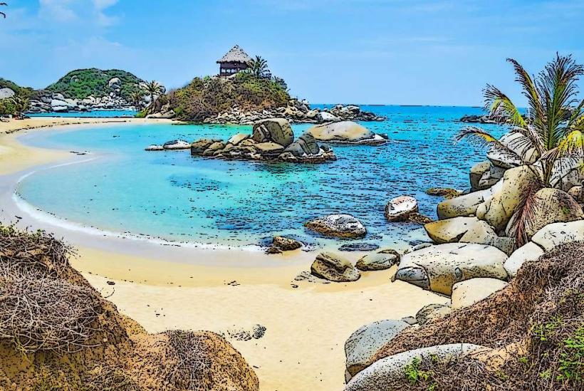
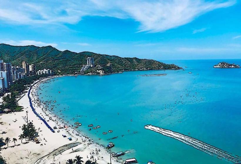
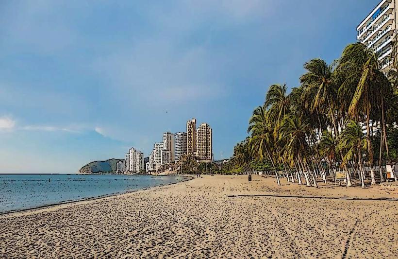
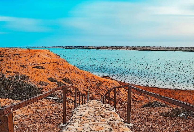
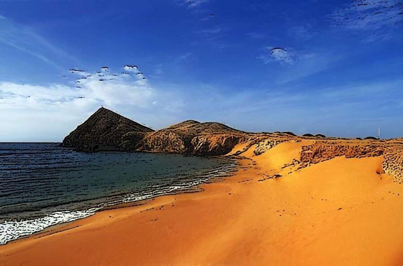
Parque Tayrona's beaches are a collection of coastal areas situated within Tayrona National Natural Park, located on the Caribbean coast of Colombia, approximately 34 kilometers from Santa Marta.
Visual Characteristics
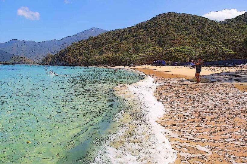
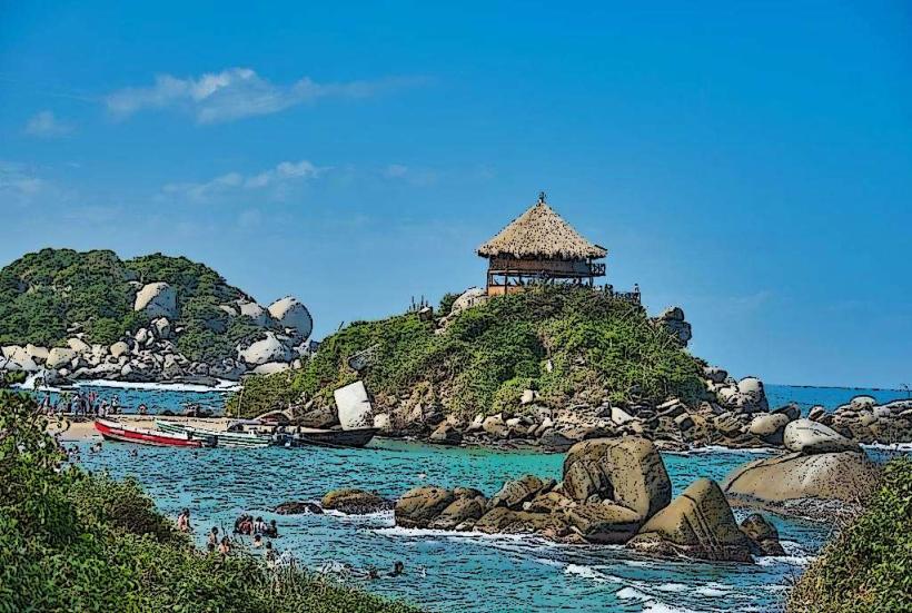
The beaches are characterized by fine, golden-yellow sand. The water exhibits a gradient of blues, from turquoise in shallow areas to deep indigo further offshore. Rocky outcrops and large granite boulders are interspersed along the shorelines. The vegetation is dense tropical rainforest, with palm trees and various broadleaf species reaching down to the sand in many sections.
Location & Access Logistics
Access to Parque Tayrona beaches is primarily via the main entrance located off the Troncal del Caribe highway (Route 90). From Santa Marta, this entrance is approximately 34 kilometers east. Private vehicles can park at the designated parking area near the entrance for a fee. Public transport options include local buses (busetas) traveling between Santa Marta and Palomino, which stop at the park entrance. From the entrance, visitors must walk or utilize a shuttle service (additional fee) to reach the main beach areas. The walk to Cabo San Juan del Guía, for example, is approximately 1.5 to 2 hours from the entrance.
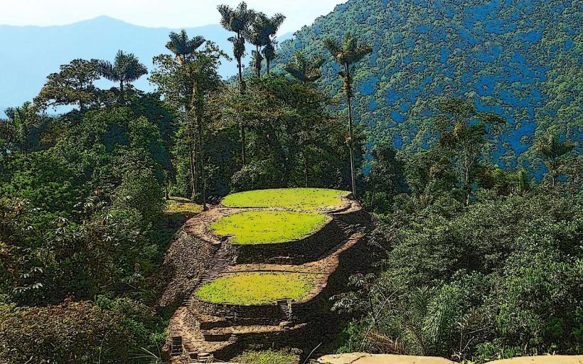
Historical & Ecological Origin
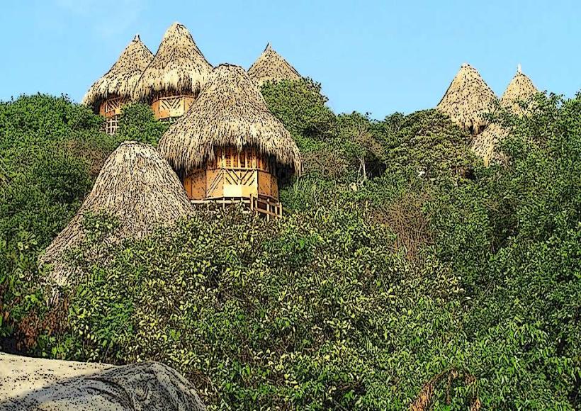
Parque Tayrona is an ecologically diverse region with a significant pre-Columbian history. The area was inhabited by the Tayrona civilization, indigenous people who developed complex agricultural and architectural systems. The park's geological formations include ancient granite formations, shaped by erosion over millennia. Ecologically, it is classified as a tropical dry forest and coastal marine ecosystem.
Key Highlights & Activities
Activities include swimming and sunbathing on beaches such as Arrecifes, La Piscina, and Cabo San Juan del Guía. Hiking is possible along designated trails connecting the beaches. Snorkeling is feasible in calmer sections, particularly at La Piscina. Birdwatching is also a common activity due to the park's biodiversity.
Infrastructure & Amenities
Restrooms are available at various points within the park, including near the main entrance and at key beach areas. Shade is provided by natural vegetation and some constructed shelters. Cell phone signal is intermittent and generally weak within the park. Food vendors and small restaurants are located at some of the more developed beach sites, offering basic meals and drinks.
Best Time to Visit
The best time for weather is during the dry season, from December to March. For photography, early morning and late afternoon offer softer light. High tide can affect the usable beach area on some smaller coves.
Facts & Legends
A local legend suggests that the granite boulders scattered along the beaches are the petrified tears of a giant who wept for his lost love. A practical tip for visitors is to carry sufficient cash, as card payment facilities are extremely limited.
Nearby Landmarks
- Palomino Beach: 15km Northeast
- Quebrada Valencia: 10km West
- Minca: 30km Southwest (inland)
- Ciudad Perdida (Lost City) Trailhead: Approximately 40km East (access point)