Information
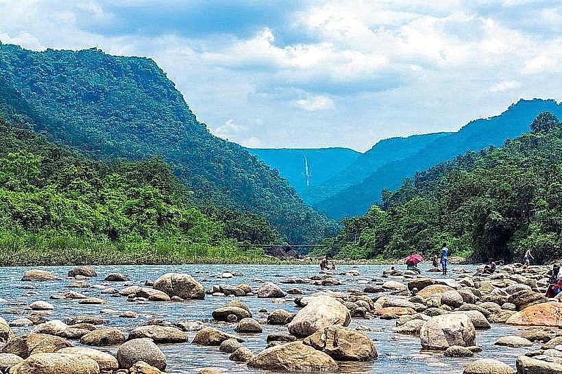
Landmark: Piyain River (Sari River)City: Sylhet
Country: Bangladesh
Continent: Asia
Piyain River (Sari River), Sylhet, Bangladesh, Asia
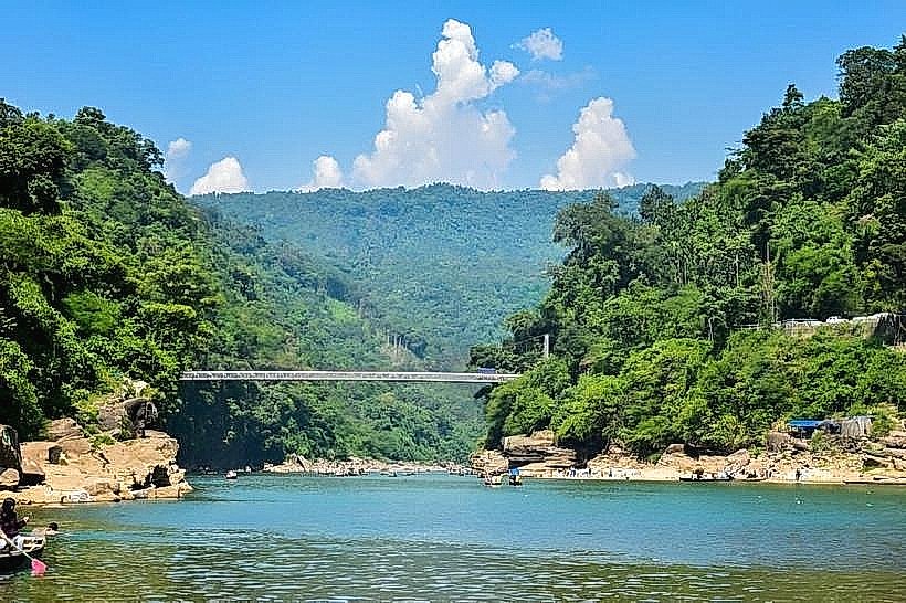
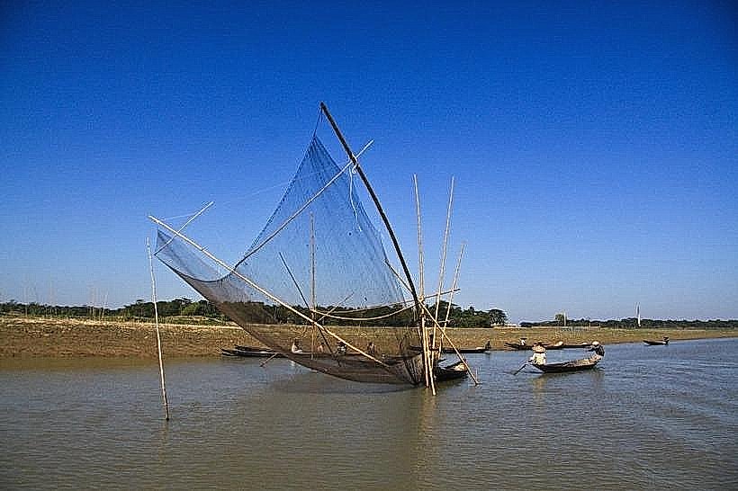
The Piyain River, also known as the Sari River, is a significant waterway located in the Sylhet Division of Bangladesh.
Visual Characteristics
The river exhibits a clear, turquoise-colored water, particularly during the dry season. Its banks are characterized by a mix of sandy deposits and dense, green vegetation, including various tree species and grasses. The riverbed is composed of smooth, rounded stones and pebbles.
Location & Access Logistics
The Piyain River is accessible from Sylhet city. The primary access point is via the Jaflong Road (Sylhet-Tamabil Road). From Sylhet city center, travel approximately 60 kilometers northeast towards the Indian border. Parking is available at designated areas near Jaflong, a popular tourist spot on the river. Local buses and private vehicles operate regularly from Sylhet's main bus terminals to Jaflong. Boat services are also available from Jaflong ghat for travel along the river.
Historical & Ecological Origin
The Piyain River is a tributary of the Surma River. Its formation is part of the complex river system of the Sylhet region, influenced by monsoon patterns and the topography of the Meghalaya Plateau in India, from where its waters originate. The river's course is shaped by alluvial deposition and erosion processes.
Key Highlights & Activities
Boating excursions are a primary activity, offering views of the river and its surroundings. Stone collection is a common sight, with local workers extracting stones from the riverbed. Swimming is possible in designated shallow areas. Hiking along the riverbanks is also an option.
Infrastructure & Amenities
Basic amenities are available in the vicinity of Jaflong. These include small food stalls selling local snacks and beverages. Restrooms are present but may be rudimentary. Cell phone signal (4G) is generally available in the populated areas near the river. Shade is provided by natural vegetation and temporary structures.
Best Time to Visit
The best time to visit for clear water and pleasant weather is during the dry season, from November to March. The late afternoon offers softer lighting for photography. High tide is not a significant factor for access, but water levels are lower and clearer in the dry months.
Facts & Legends
The river is a major source of construction stones, which are extracted and transported downstream. A local belief suggests that the river's clear waters have purifying properties.
Nearby Landmarks
- Jaflong Zero Point (0.2km North)
- Tamabil Land Port (2.5km Northeast)
- Khasi Hills (5km North)
- Sripur (3km West)