Information
Landmark: Ruins of ForticaCity: Pag
Country: Croatia
Continent: Europe
Ruins of Fortica, Pag, Croatia, Europe
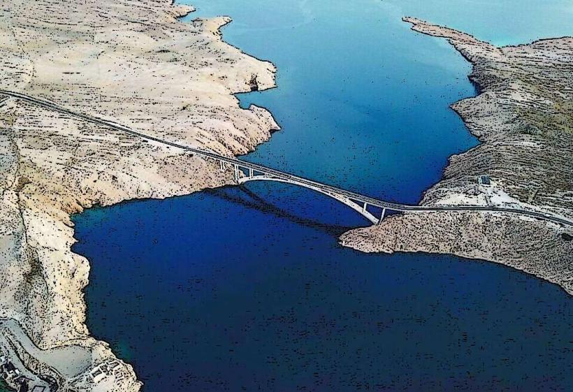
The Ruins of Fortica are the remains of a 17th-century Venetian fortress situated on the northwestern edge of Pag Island. It overlooks the Ljubač Strait and the Pag Bridge, occupying a strategic high point that once controlled maritime access between the mainland and the island.
Visual Characteristics
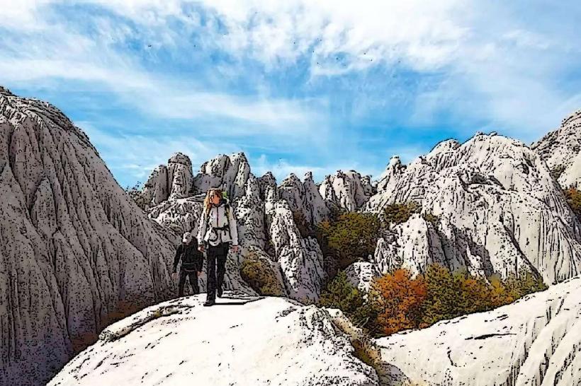
The site consists of weathered limestone foundations and remnants of thick defensive walls. The primary structure is a square tower base constructed from local unrefined karst stone. The ruins are sparsely vegetated with low-lying Mediterranean scrub and immortelle, surrounded by a jagged, white limestone lunar landscape that provides high contrast against the turquoise water of the strait.
Location & Access Logistics
The ruins are located approximately 500 meters north of the Pag Bridge (Paški most). Access is via a marked gravel path branching off the D106 state road. There is a small gravel pull-off for parking near the trailhead. Visitors must traverse roughly 300 meters of uneven, rocky terrain on foot to reach the fortification. No public transportation stops directly at the ruins; the nearest bus stop is in the village of Miškovići, 5 kilometers to the south.
Historical & Ecological Origin
The fortress was constructed in the 17th century by the Venetian Republic to monitor and defend against Ottoman incursions and Uskok pirate raids. It served as a strategic lookout point for the Velebit Channel. Geologically, the site is positioned on a karst plateau characterized by extreme wind erosion and high salinity, which has contributed to the skeletal preservation of the masonry.
Key Highlights & Activities
The primary activity is observing the 360-degree panoramic view, which encompasses the Velebit Mountain range, the Pag Bridge, and the surrounding Zadar archipelago. The site is a focal point for hikers exploring the southern Pag trail network. Photography of the Bridge and the strait from the fortress elevation is a common objective.
Infrastructure & Amenities
There is zero infrastructure at the site. No restrooms, trash bins, or shaded areas are available. 5G and 4G cellular signals are consistently strong due to the unobstructed line of sight to mainland towers. Visitors must bring water and wind protection, as the site is highly exposed to the Bura wind.
Best Time to Visit
Optimal lighting for photography occurs during the "blue hour" or at sunset, when the Velebit mountains reflect orange hues. The best months for visiting are May, June, and September to avoid the extreme summer heat and the high-velocity winter winds. It is advised to avoid the site during a Bura alert, as wind gusts on this exposed ridge can exceed 100 km/h.
Facts & Legends
Local accounts suggest that the fortress was linked to a signaling system using smoke by day and fire by night to communicate with other Venetian watchtowers along the coast. A common local myth claims that hidden tunnels once ran from the fortress down to the sea to allow for the secret resupply of the garrison during sieges, though no physical evidence of such tunnels exists today.
Nearby Landmarks
Pag Bridge (Paški most) – 0.6km South
Miletići Beach – 2.5km Southeast
Ražanac Fortress – 4.8km South
Ljubotić Archeological Site – 4.2km Southwest
Veliko Blato Bird Reserve – 4.5km Northwest