Information
Landmark: Velebit Nature ParkCity: Pag
Country: Croatia
Continent: Europe
Velebit Nature Park, Pag, Croatia, Europe
Velebit Nature Park is a vast protected mountain range in Croatia, a portion of which directly borders the Pag Channel, creating the dramatic "lunar" backdrop visible from the island. While the park's primary mass is on the mainland, its ecological and climatic influence defines the entire eastern coastline of Pag.
Visual Characteristics
The park is characterized by rugged karst topography, including massive limestone peaks, deep canyons, and vertical cliffs. The seaward slopes facing Pag are almost entirely devoid of vegetation due to salt spray and wind, appearing as a stark white stone wall. The interior contains dense forests of beech and fir, subterranean caves, and the prominent Tulove Grede rock formations.
Location & Access Logistics
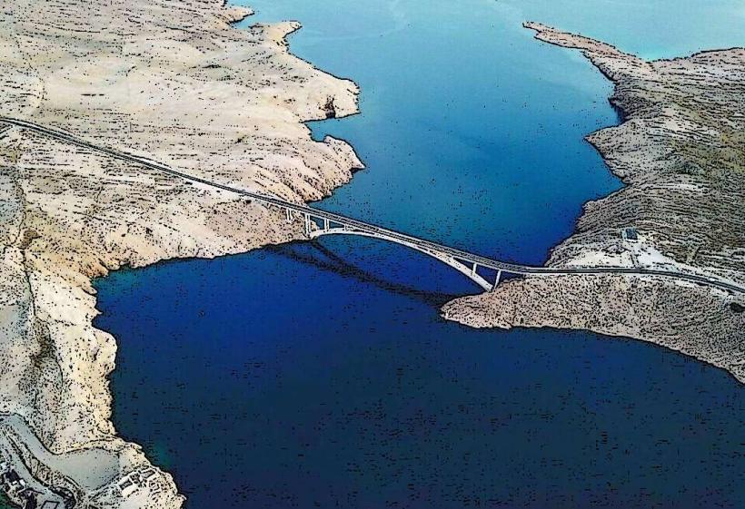
The park is accessed from the mainland via the E71 highway or the D8 Adriatic coastal road (Jadranska magistrala). Primary entry points are at Starigrad-Paklenica (45km south of the Pag Bridge) and the Baške Oštarije mountain pass (accessible via ferry from Žigljen to Prizna). There is no direct vehicular access to the park from Pag Island; travelers must use the Pag Bridge or the Prizna-Žigljen ferry to reach the mainland trailheads.
Historical & Ecological Origin
Designated as a Nature Park in 1981, it is the largest protected area in Croatia and a UNESCO Biosphere Reserve. The range formed through tectonic uplifting of carbonate rocks during the Alpine orogeny. Historically, the mountain served as a strategic barrier and a primary route for seasonal transhumance, where shepherds moved livestock between the coast and high mountain pastures.
Key Highlights & Activities
Hiking is the primary activity, with over 150 kilometers of marked trails including the Premužić Trail. Rock climbing is concentrated in the Paklenica National Park section, which is an enclave within the Nature Park. High-altitude photography provides vistas of the entire Zadar archipelago and Pag. Caving is possible at the Cerovac Caves near Gračac.
Infrastructure & Amenities
Infrastructure varies by zone; mountain huts (planinarski dom) provide basic lodging and pit toilets at strategic intervals. 4G cellular signal is available on peaks with line-of-sight to the coast but is nonexistent in deep canyons and interior valleys. There are no food vendors or potable water sources within the wilderness areas; hikers must carry all necessary supplies.
Best Time to Visit
May through September is the optimal window for high-altitude hiking to avoid snow cover. The early morning provides the most stable atmospheric conditions for photography before coastal haze develops. Winter visits are discouraged for non-professionals due to extreme "Bura" winds that can reach hurricane force on the exposed ridges.
Facts & Legends
The Velebit range is the setting for many Croatian folk myths, most notably as the home of the Vile (mountain nymphs) who were said to protect the springs. A verified historical oddity is the Mirila-stone funerary monuments found along mountain paths where the bodies of the deceased were laid down for a final rest before being carried to the cemetery.
Nearby Landmarks
Paklenica National Park – 0.5km (Interior enclave)
Tulove Grede – 15km Southeast
Zrmanja Canyon – 20km South
Cerovac Caves – 25km Southeast
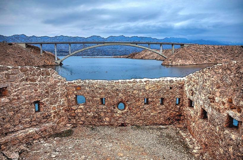
Pag Bridge – 12km West (across the channel)