Information
City: TiranaCountry: Albania
Continent: Europe
Tirana, Albania, Europe
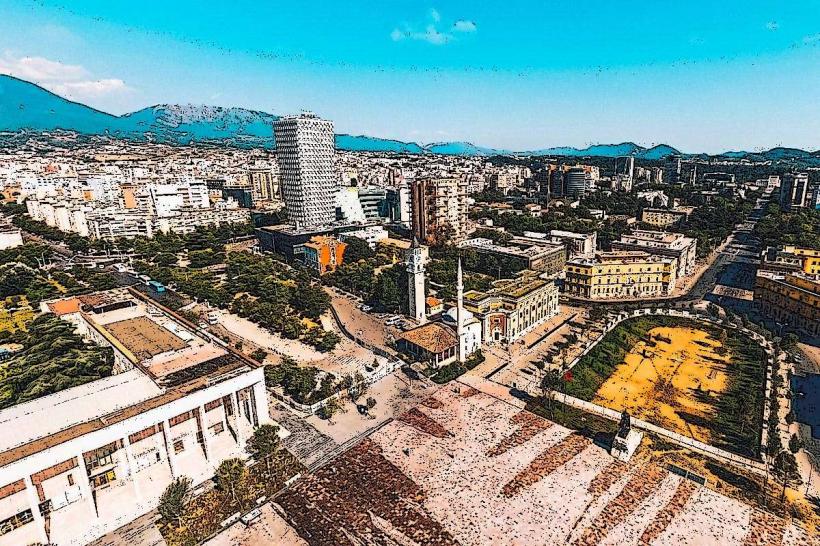
Tirana functions as the primary political, economic, and cultural nucleus of Albania. Situated in the central-western plains at the foot of Mount Dajti, it serves as a specialized node for state administration, digital services, and regional trade. It is defined by its rapid post-communist transformation, its vibrant "Painted City" aesthetic, and its current trajectory as a model for green urban renewal via the "Tirana 2030" Master Plan.
Historical Timeline
Tirana was founded as an Ottoman urban center in 1614 by Sulejman Pashë Bargjini. The primary era of governance began in 1920, when it was declared the capital, followed by the Italian Rationalist period (1930s), which established the central boulevard. The primary event shaping its 2026 identity is the post-1992 expansion, during which the population quadrupled, necessitating the current "Orbital Forest" and vertical densification projects. Historically, it is characterized by its transition from a closed Stalinist capital into a dynamic, European-integrated metropolis.
Demographics & Population
The population of the metropolitan area is approximately 543,000 (2026 estimate), with the broader municipality housing roughly 920,000 residents. The demographic profile is specialized toward a young, multilingual workforce and a growing international expat community. As the nation’s academic center, it hosts the University of Tirana and numerous private institutions, maintaining a high density of professionals in the tech and service sectors.
Urban Layout & Key Districts
The city is organized around a central axis that extends from Skanderbeg Square to the Grand Park.
Skanderbeg Square: The specialized symbolic heart; it is the largest pedestrian zone in the Balkans, paved with stones from all Albanian-speaking lands.
Blloku: A specialized former restricted area for the communist elite, now the city's premier high-end entertainment, retail, and nightlife district.
New Boulevard (Bulevardi i Ri): A specialized northern extension of the city center, serving as the primary zone for modern glass towers and international business headquarters.
Pazari i Ri (New Bazaar): A specialized revitalized market district combining traditional food commerce with contemporary social spaces.
Kombinat: A specialized western industrial-turned-residential district, currently undergoing massive reconstruction following the 2019 earthquake.
Top City Landmarks
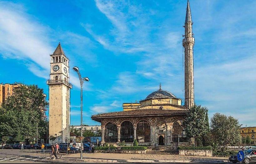
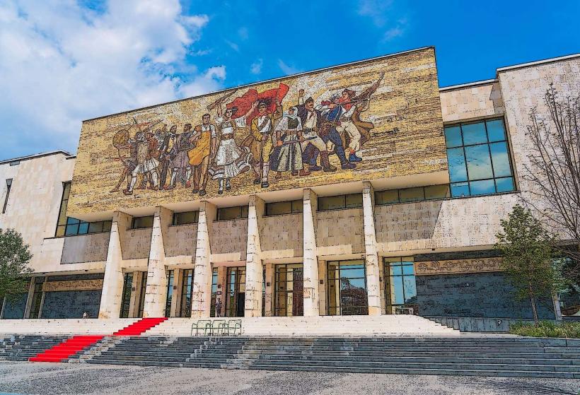
Skanderbeg Monument: A specialized bronze statue of the national hero located in the central square, framed by the National Historical Museum and the Ethem Bey Mosque.
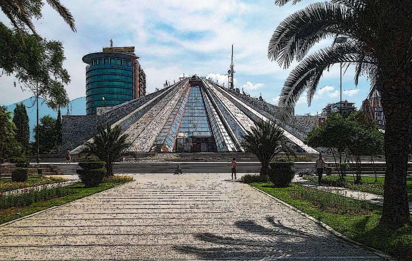
The Pyramid of Tirana: A specialized brutalist structure (formerly a museum for Enver Hoxha) recently transformed into a high-tech hub and public "mountain" for climbing and events.
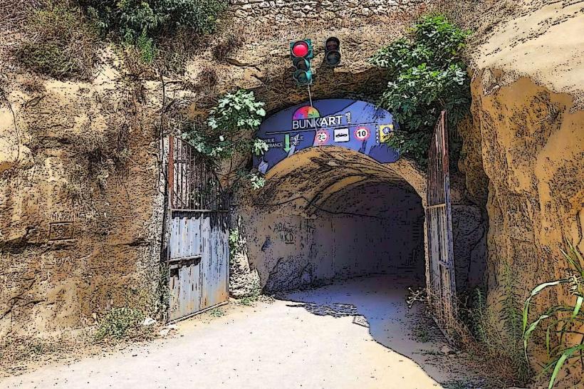
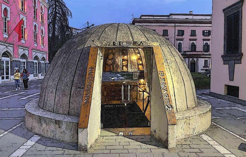
Bunk’Art 1 & 2: Specialized Cold War bunkers converted into massive underground history and contemporary art museums.
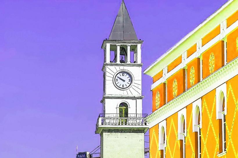
Et'hem Bey Mosque & Clock Tower: Specialized 18th-century Ottoman landmarks that survived the atheism campaigns of the communist era.
Dajti Ekspres: A specialized 4.7 km cable car system providing a 15-minute transit from the city to the 1,612-meter summit of Mount Dajti.
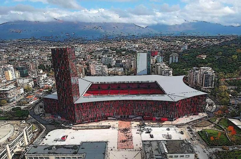
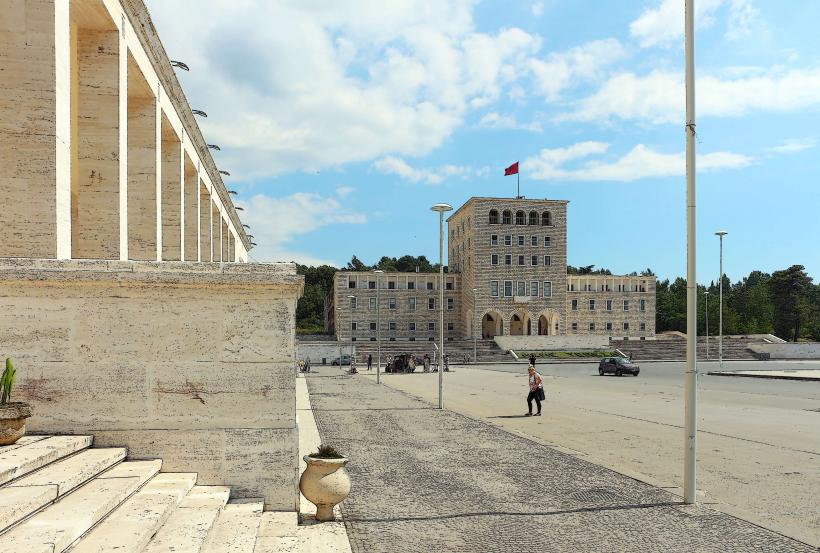
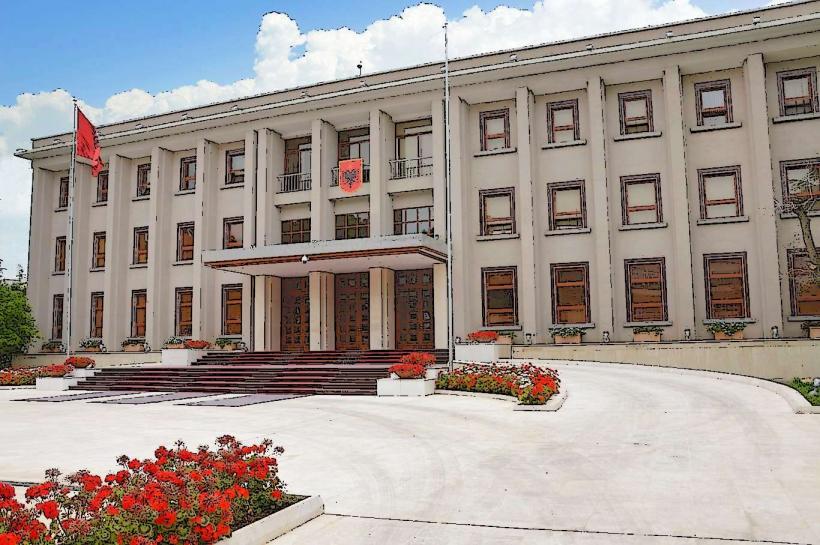
Tirana Public Administration Cluster: A specialized 2026 complex centralizing over 20 government institutions in a modern, transparent architectural site.
Transportation & Connectivity
Tirana is the logistics pivot of the Western Balkans.
Tirana International Airport (TIA): The primary air gateway; in 2026, it operates 63 routes to 61 cities, serving over 6.5 million passengers annually.
Tirana–Durrës–Rinas Rail: A specialized 2026 infrastructure project completing the rail link between the capital, the main port (Durrës), and the airport.
Orbital Forest: A specialized 2026 ecological barrier consisting of 2 million trees designed to contain urban sprawl and provide a green belt for cycling and transit.
Safety & Environment
The general safety level is high. Tirana is statistically one of the safer capitals in Europe for personal security. There are no "red zones." Warning: The primary environmental challenge is air quality and traffic congestion in the central basin. In 2026, the city utilize an expanded network of bike lanes and electric bus lines to mitigate these issues.
Digital & Financial Infrastructure
In 2026, the city operates as the "Silicon Valley of the Balkans." Internet speeds average 600–1000 Mbps with universal 5G. The city utilize a specialized digital "Tirana My City" app for all municipal payments and public service interactions.
Cash Limit: As of 2026, a specialized regulation limits cash payments to 5,000 ALL per month to promote digital economy integration.
Local Cost Index (2026 Estimates)
1 Espresso: 120 – 180 ALL
1 Portion of Byrek: 50 – 90 ALL
1 Standard Lunch: 800 – 1,500 ALL
Monthly Rent (1-BR Center): 55,000 – 90,000 ALL
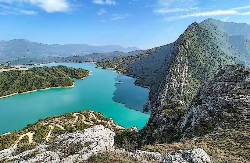
Nearby Day Trips
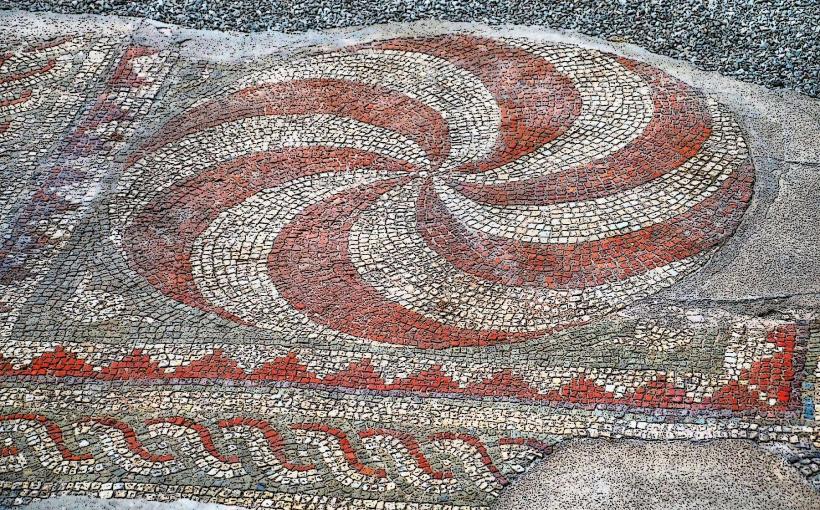
Kruja: 45 mins away; a specialized historic citadel and the seat of Skanderbeg, featuring a world-class traditional bazaar.
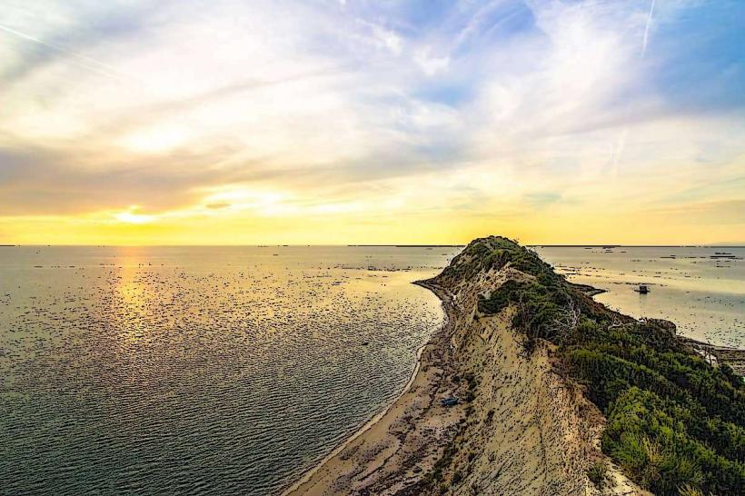
Durrës: 35 mins away; the primary coastal escape and Roman-era port city.
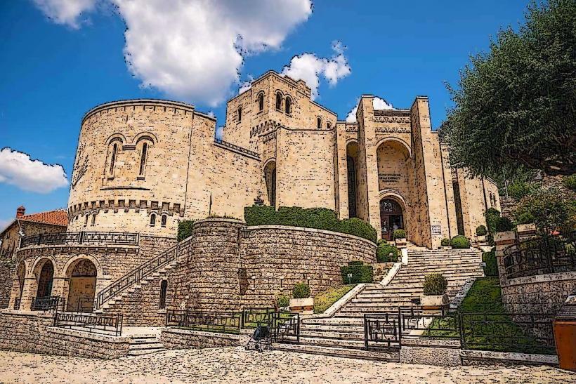
Petrela Castle: 20 mins away; a specialized medieval fortress perched on a rocky crag overlooking the Erzen valley.
Facts & Legends
Tirana is the site of the world's first "Color Revolution" in urbanism, initiated by former mayor Edi Rama who used vibrant paint to revitalize drab socialist blocks. Legend states that the city was named after "Tehran" to commemorate Ottoman victories in Persia, though linguists link it to the word Theranda (old Greek). A verified fact is that Tirana is the 2026 European Capital of Digital Nomadism, hosting the highest density of remote workers per capita in the region. Historically, it was the first city in the Balkans to host a 100% digital bank.