Information
Landmark: Bovilla ReservoirCity: Tirana
Country: Albania
Continent: Europe
Bovilla Reservoir, Tirana, Albania, Europe
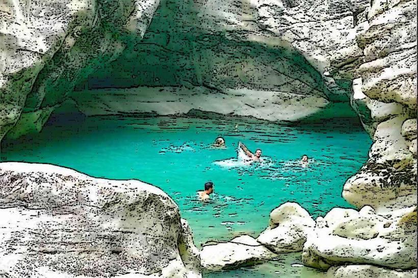
Bovilla Reservoir (Ujëmbledhësi i Bovillës) is the primary water source for the city of Tirana, located approximately 15 kilometers northeast of the capital within the Dajti National Park.
Visual Characteristics
The reservoir is characterized by its deep turquoise-to-emerald water, which contrasts sharply with the surrounding grey limestone cliffs of the Krujë-Dajt mountain range. The terrain is defined by the Gamti Mountain (Mali i Gamtit) and Brari Mountain, featuring sheer vertical rock faces, karst formations, and Mediterranean shrub vegetation.
Location & Access Logistics
Access is via the Zall-Herr road from Tirana. The first segment is paved, while the final 5–7 kilometers approaching the dam and the climbing areas consist of unpaved, rocky terrain. High-clearance vehicles are recommended, though standard cars can navigate with caution during dry conditions. There is no direct public transport; visitors use private vehicles, taxis, or organized hiking tours. Informal parking is available near the dam and at the base of the Gamti hiking trail.
Historical & Ecological Origin
The reservoir was created in 1996 by damming the Tërkuzë River to address Tirana’s increasing water demand. The dam is a rock-fill structure reaching 91 meters in height. Ecologically, it sits in a protected zone where human activity is restricted to ensure water purity. The surrounding mountains are composed of Mesozoic limestone, shaped by tectonic uplift and water erosion.
Key Highlights & Activities
Hiking: The ascent to the Gamti Mountain Balcony is the primary activity, providing the most photographed panoramic view of the reservoir.
Rock Climbing: The vertical cliffs near the dam feature several established bolted routes for sport climbing, ranging from beginner to advanced difficulty.
Photography: The juxtaposition of the blue water and jagged peaks is a central focus for landscape photography.
Observation: The dam area serves as a viewpoint for the Tërkuzë canyon.
Infrastructure & Amenities
Infrastructure is limited. A small number of private restaurants and cafes are located on the road leading to the dam and at the Gamti trailhead. There are no public restrooms or electricity sources around the reservoir itself. Swimming and boating are strictly prohibited as the water is for human consumption. Cellular signal (4G) is generally reliable on the peaks but intermittent in the canyons.
Best Time to Visit
The optimal window is from March to June and September to November. High summer (July–August) can be extremely hot for the exposed Gamti hike, while winter rains can make the unpaved access road difficult to navigate. For photography, the late afternoon provides the best light on the western faces of the Gamti cliffs.
Facts & Legends
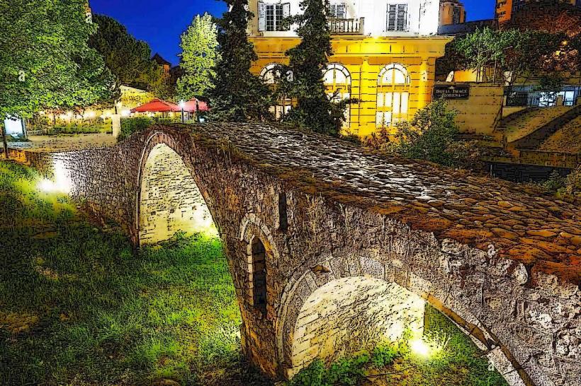
A verified technical fact is that the reservoir provides over 50% of Tirana's drinking water, processed at the nearby Bovilla Water Treatment Plant. While the lake is man-made and lacks ancient legends, the surrounding "Brari Bridge" (Ura e Brarit) is a nearby Ottoman-era stone structure that was historically part of the caravan route connecting Tirana to the Dibra region.
Nearby Landmarks
Gamti Mountain Balcony: 1.5km North (via hiking trail)
Brari Ottoman Bridge: 6.0km South
Dajti Mountain: 10.0km Southeast
Shtamë Pass National Park: 15.0km North
Tirana City Center: 18.0km Southwest