Information
Landmark: Roman Fortress of OvechCity: Varna
Country: Bulgaria
Continent: Europe
Roman Fortress of Ovech, Varna, Bulgaria, Europe
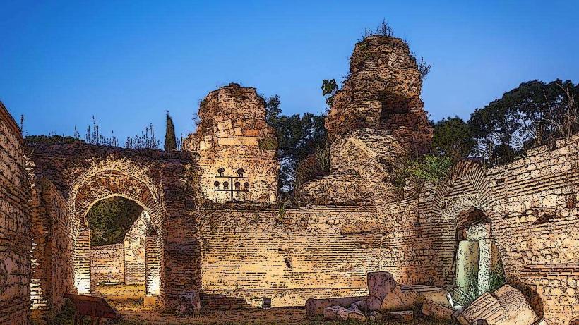
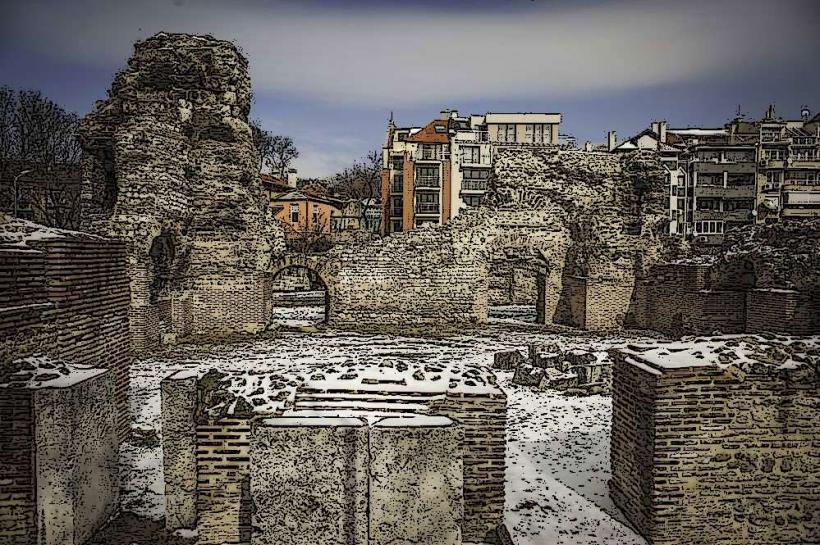
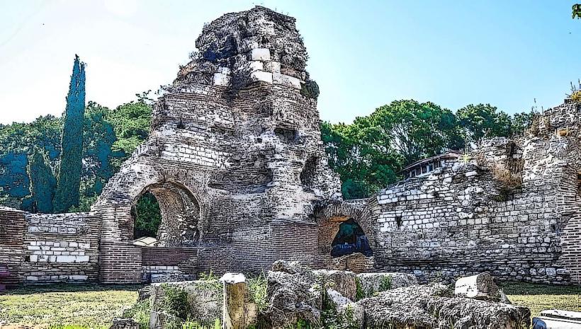
Ovech Fortress is a medieval stone stronghold located on a massive plateau known as Kaleto, situated above the modern town of Provadia and 53 km west of Varna. It served as a critical defensive bastion for the First and Second Bulgarian Empires, controlling the strategic mountain passes and the road leading to the maritime capital.
Visual Characteristics
The fortress is built upon a natural ship-shaped rock massif with vertical cliffs reaching heights of up to 25 meters. The site features reconstructed stone walls, a massive 150-meter-long wooden bridge structure connecting the plateau to the neighboring Tabiite ridge, and three main entrances carved directly into the limestone. Key ruins include a large metropolitan church, a 79-meter-deep karst well, and several grain storage pits (silos) carved into the rock.
Location & Access Logistics
From Varna, follow the A2 Hemus Motorway west, taking the exit for Provadia via Road 208. Upon entering Provadia, follow the directional signs to "Krepost Ovech." Access to the plateau is via two primary routes: a steep metal spiral staircase at the eastern side or a stone-paved path following the northern gate. A gravel parking area is located at the base of the hill. Regular trains and buses connect Varna to the Provadia station, located 2 km from the fortress entrance.
Historical & Ecological Origin
The site was originally a Byzantine fortification (Provat) established in the 4th century to defend against northern tribal incursions. It reached its zenith under the Bulgarian Tsars, becoming a major administrative and religious center. Geologically, the Kaleto plateau is a part of the Provadia Plateau system, a karst formation characterized by limestone strata, deep caves, and unique erosional rock pillars.
Key Highlights & Activities
Visitors can traverse the 150-meter-long wooden bridge for panoramic views of the Provadia valley and the Balkan Mountains. Exploration of the 79-meter-deep well and the remains of the Bishop's Basilica is possible. The plateau features multiple hiking paths along the cliff edges and the remains of medieval residential quarters. Photography of the "Devil's Bridge" rock formation is a primary activity.
Infrastructure & Amenities
The site features a ticket office at the base of the eastern stairs. Information plaques are installed at major archaeological points. 5G and 4G cellular signals are stable across the plateau. There is very little shade on the flat summit; visitors should prepare for sun exposure. Basic restrooms are available at the entrance. Food and beverage vendors are located in the town of Provadia, 500 meters from the site base.
Best Time to Visit
The optimal time for visiting is between May and October. Photography is best during the "golden hour" before sunset, as the light emphasizes the vertical limestone cliffs and the wooden bridge structure. Winter visits can be hazardous due to wind and ice on the exposed wooden walkways and metal stairs.
Facts & Legends
Ovech is famous for its 79-meter-deep well, which was essential for surviving long sieges. Local tradition maintains that the fortress was never taken by force but only through treachery or the exhaustion of supplies. During the 14th century, the fortress was so significant that it was mentioned by the Arab traveler Al-Idrisi as a "large and famous city."
Nearby Landmarks
Provadia Historical Museum – 1.5km Southwest
Saltworks (Provadia-Solnitsata) – 6km South
Madara Rider (Global Heritage Site) – 28km West
Shumen Fortress – 42km West
Petrich Kale Fortress – 18km Southeast