Information
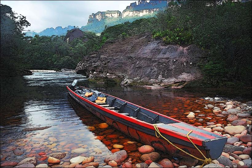
Landmark: Canoe Trip in CanaimaCity: Canaima National Park
Country: Venezuela
Continent: South America
Canoe Trip in Canaima, Canaima National Park, Venezuela, South America
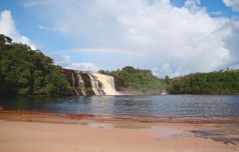
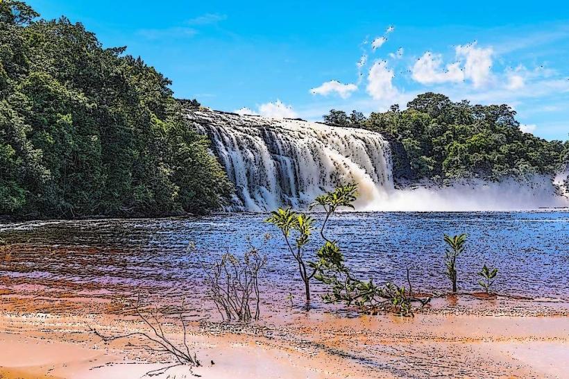
Canoe trips are a primary mode of transport and activity within Canaima National Park, located in Venezuela's Bolívar State.
Visual Characteristics
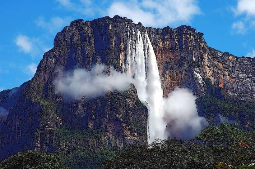
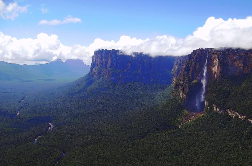
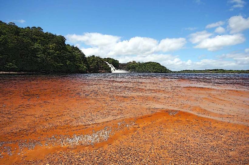
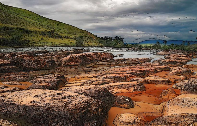
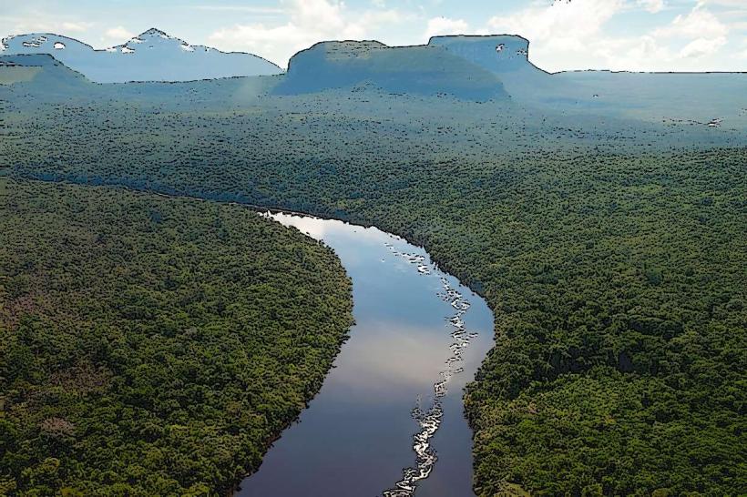
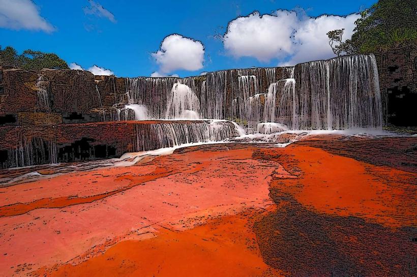
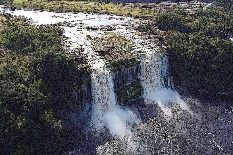
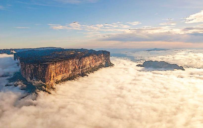
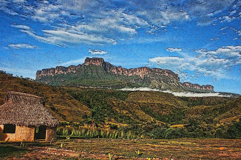
The park features extensive rainforest, savanna, and tepuis (table-top mountains). Rivers are typically brown due to tannins from decaying vegetation. Waterfalls, such as Angel Falls, are prominent features. Vegetation is dense in forested areas and sparser on savannas.
Location & Access Logistics
Canaima National Park is accessible primarily by air. The main entry point is Canaima Camp, which has a small airstrip (CAJ) receiving flights from Caracas and Puerto Ordaz. From Canaima Camp, river transport via motorized dugout canoes (curiaras) is the standard method for reaching other areas, including the base of Angel Falls. Road access is extremely limited and not practical for tourists.
Historical & Ecological Origin
Canaima National Park was established in 1975. Its geological origins are ancient, with the tepuis being some of the oldest geological formations on Earth, dating back to the Precambrian era. The park protects a significant portion of the Guiana Shield's biodiversity.
Key Highlights & Activities
Canoe trips are essential for navigating the park's waterways. Activities include boat excursions to the base of Angel Falls, exploring smaller waterfalls like Sapo and Hacha Falls (requiring short hikes), swimming in natural pools, and observing local flora and fauna. Overnight stays in hammock camps are common for multi-day excursions.
Infrastructure & Amenities
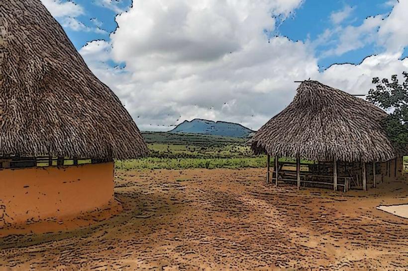
Basic infrastructure exists in Canaima Camp, including lodges, restaurants, and limited shops. Cell phone signal is unreliable and generally absent outside of Canaima Camp. Restrooms and basic shelter are available at designated campsites and lodges. Food is typically provided as part of organized tours.
Best Time to Visit
The dry season, from December to April, offers lower water levels, which can make some river sections more challenging but also expose more beaches. The wet season, from May to November, results in higher water levels, facilitating easier navigation and more powerful waterfalls. For photography of waterfalls, early morning or late afternoon light is preferable.
Facts & Legends
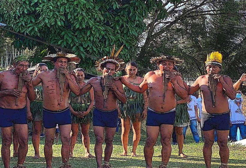
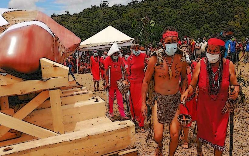
The indigenous Pemón people have inhabited this region for centuries and are the primary guides for canoe trips. Local legends speak of the tepuis as the dwelling places of spirits.
Nearby Landmarks
- Angel Falls (Salto Ángel) - 10km Southwest
- Hacha Falls (Salto Hacha) - 2km West
- Sapo Falls (Salto Sapo) - 2km West
- Uruyén Camp - 15km Southwest
- Kavak Camp - 25km Southeast