Information
Landmark: Kamarata ValleyCity: Canaima National Park
Country: Venezuela
Continent: South America
Kamarata Valley, Canaima National Park, Venezuela, South America
Kamarata Valley is a geographical depression located within Canaima National Park in Venezuela.
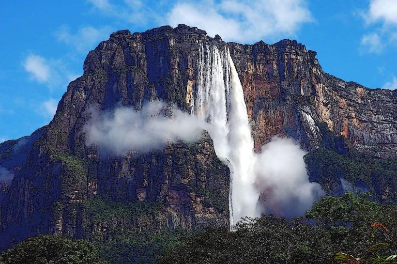
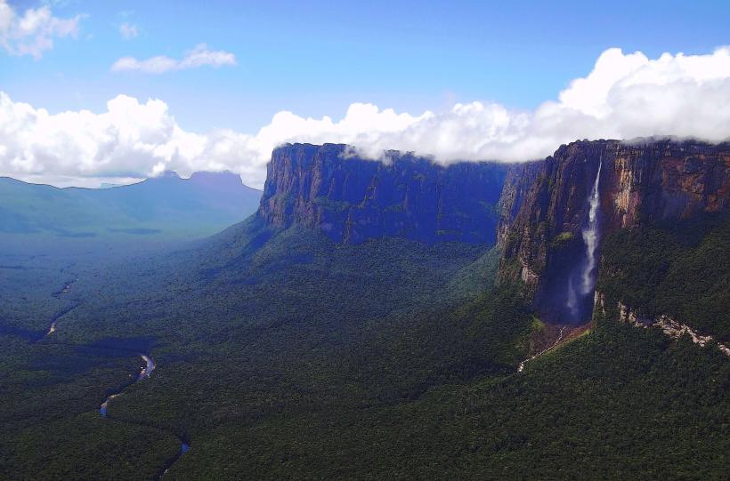
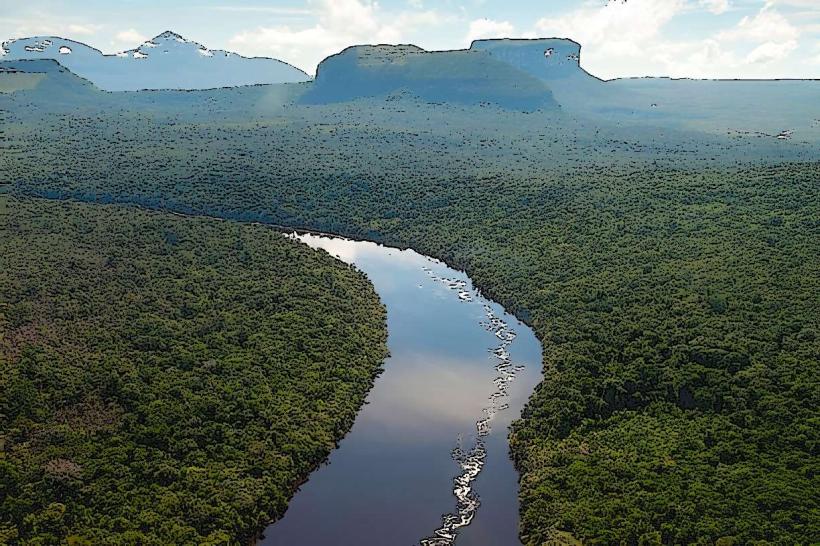
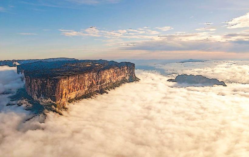
This valley serves as a primary access point to the Auyán-tepui massif.
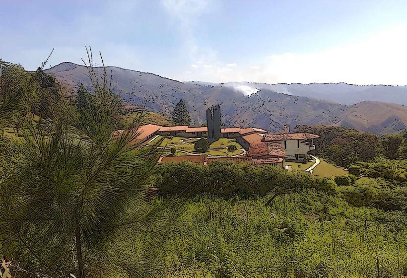
Visual Characteristics
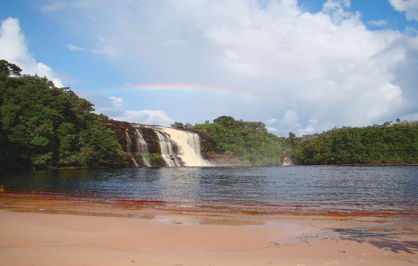
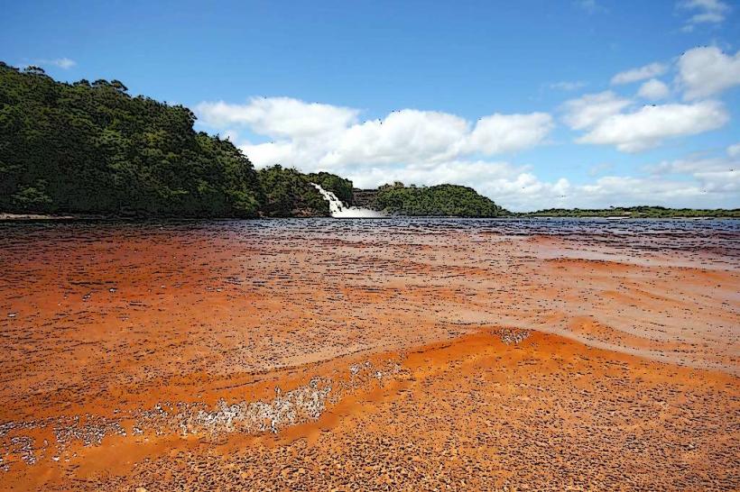
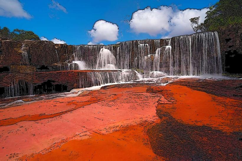
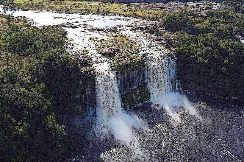
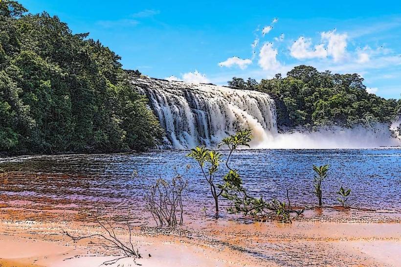
The valley floor is characterized by savanna vegetation interspersed with gallery forests along watercourses. The dominant geological feature is the sheer, vertical cliff face of Auyán-tepui, composed of Precambrian quartzite. The tepui's summit is obscured by cloud cover for significant portions of the year. Rivers within the valley exhibit clear, dark water due to tannins leached from vegetation.
Location & Access Logistics
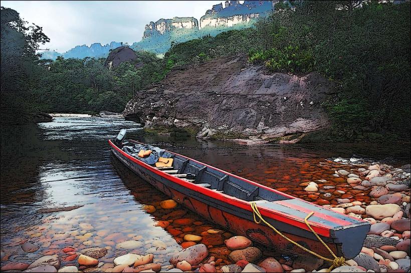
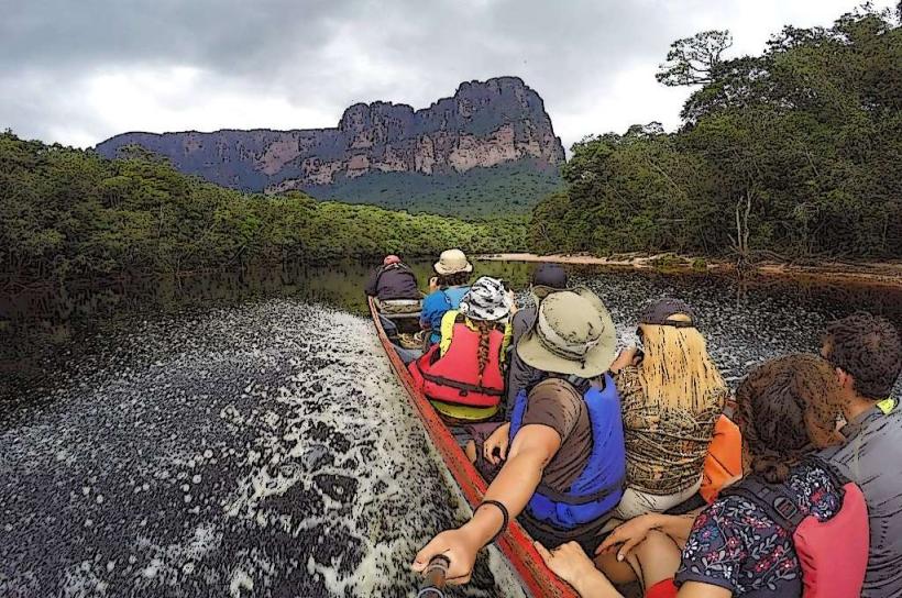
Kamarata Valley is situated in the southeastern sector of Canaima National Park. Access is primarily via small aircraft landing on a dirt airstrip (SVCN) located within the valley. The airstrip is approximately 10 kilometers from the nearest indigenous Pemón settlement. There are no public roads leading to Kamarata Valley. Transportation within the valley is typically by foot or motorized canoe along the Carrao River and its tributaries.
Historical & Ecological Origin
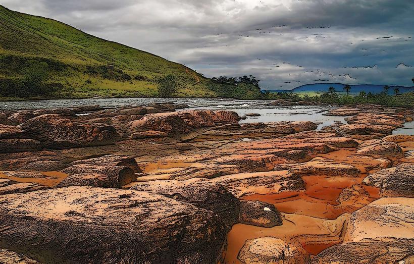
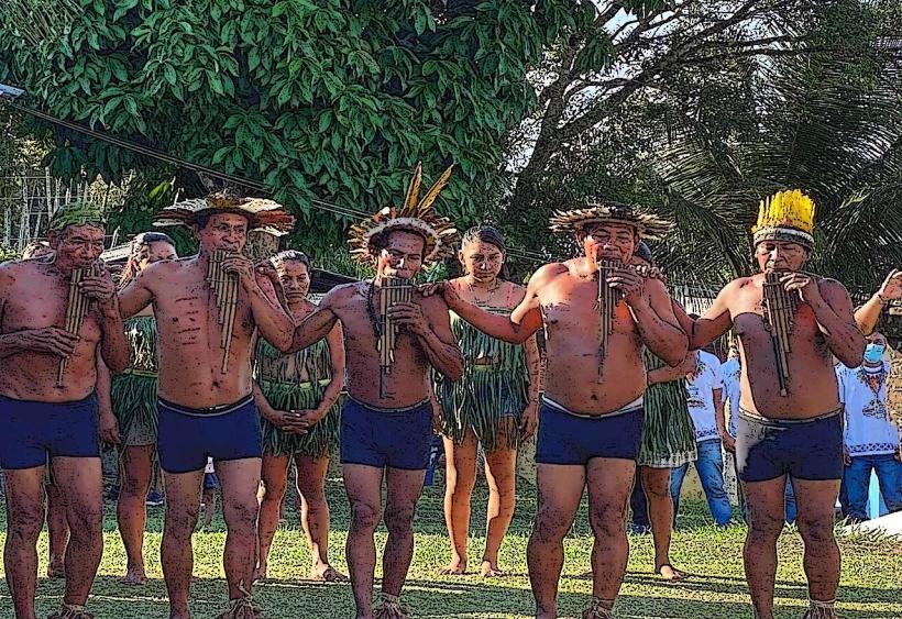
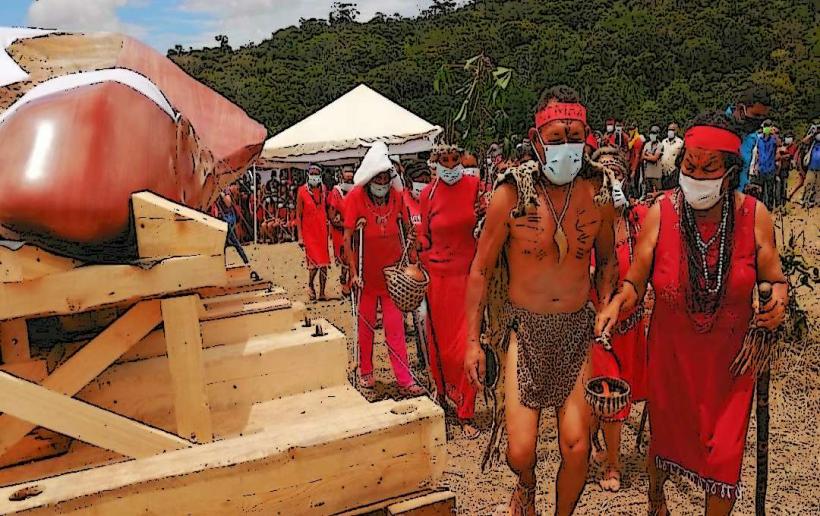
The valley is a result of erosion acting upon the ancient Precambrian sandstone of the Guiana Shield, forming the distinctive tepui formations. The area is part of the Neotropical realm, supporting a unique ecosystem adapted to the nutrient-poor soils and high rainfall. The Pemón indigenous people have inhabited this region for centuries, utilizing its resources for sustenance and cultural practices.
Key Highlights & Activities
Hiking to the base of Auyán-tepui's waterfalls is a primary activity. Boat excursions along the Carrao River provide views of the tepui's escarpment. Birdwatching is possible, with species such as the Guianan cock-of-the-rock present. Visits to local Pemón communities offer insight into their way of life.
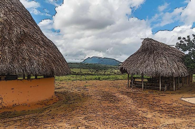
Infrastructure & Amenities
Basic accommodation, often in the form of simple lodges or hammocks, is available in the vicinity of the airstrip and in nearby Pemón settlements. Restrooms are rudimentary and vary by location. Shade is provided by natural tree cover and lodge structures. Cell phone signal is generally absent. Limited food options are available through local guides or community kitchens.
Best Time to Visit
The dry season, from December to April, offers the most reliable weather for air travel and outdoor activities. During this period, water levels are lower, facilitating river travel. The wet season (May to November) can lead to flight cancellations and increased river flow, making access more challenging.
Facts & Legends
The Kamarata Valley is the traditional territory of the Pemón people, who believe the tepuis are home to spirits. Local legends speak of the "Mawari," mischievous spirits said to inhabit the waterfalls and forests.
Nearby Landmarks
- Canaima Lagoon (15km Northwest)
- Angel Falls (approximately 50km Southwest, accessible by multi-day river trip)
- Sapo Falls (12km Northwest)
- Uruyén (4km West)