Information
Landmark: Gran SabanaCity: Canaima National Park
Country: Venezuela
Continent: South America
Gran Sabana, Canaima National Park, Venezuela, South America
The Gran Sabana is a vast savanna region located within Canaima National Park in southeastern Venezuela.
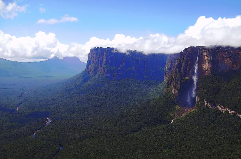
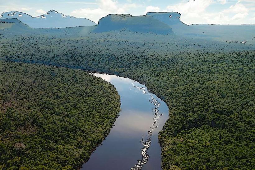
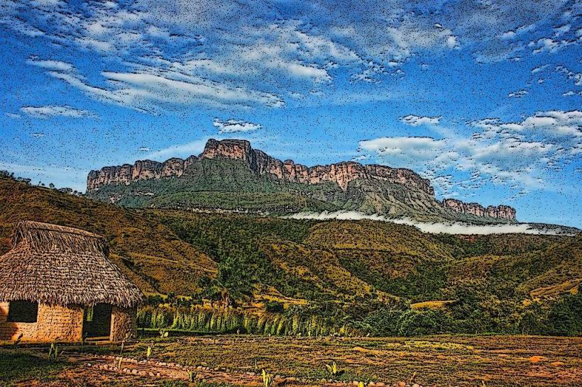
This area is characterized by its extensive plains, tepuis (table-top mountains), and diverse ecosystems.
Visual Characteristics
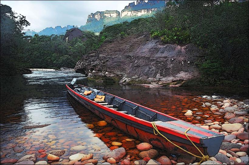
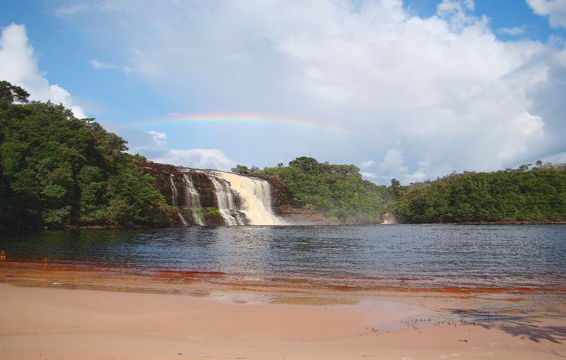
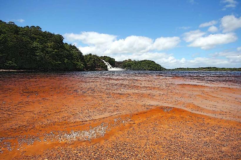
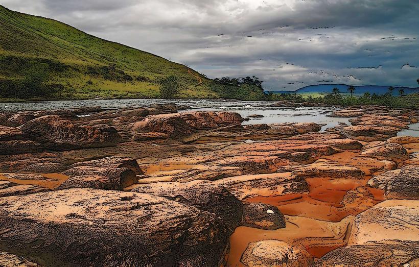
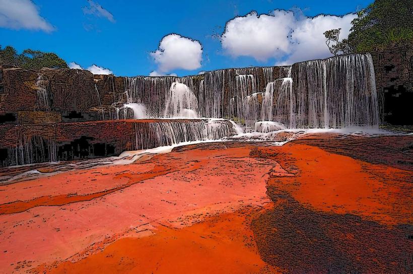
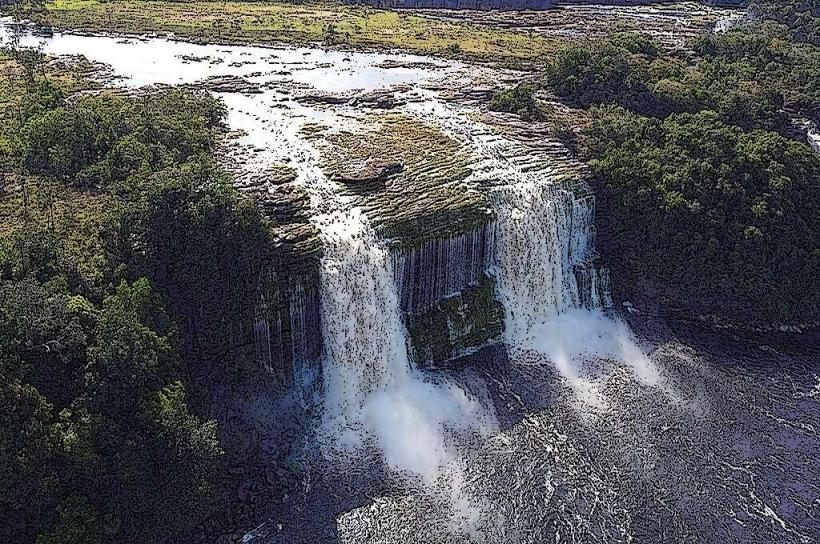
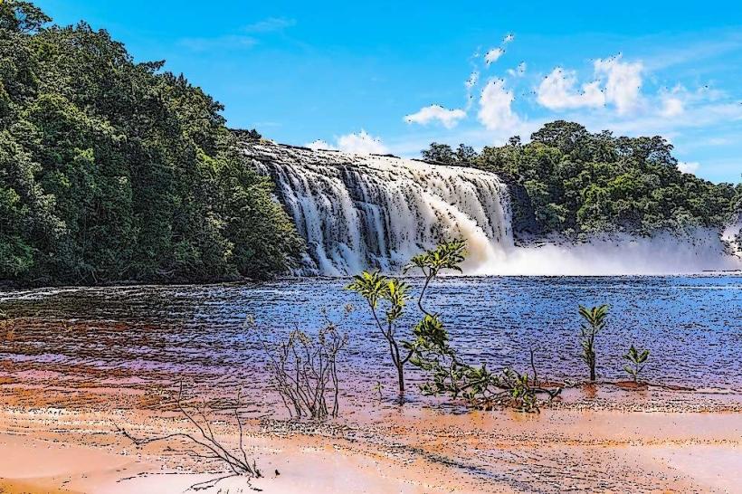
The landscape consists of rolling grasslands interspersed with dense gallery forests along riverbanks. Numerous sandstone table-top mountains, known as tepuis, rise abruptly from the savanna floor, presenting sheer vertical cliffs. The vegetation is predominantly savanna grasses, with patches of shrubland and tropical rainforest in the higher elevations and river valleys. Rivers are typically clear or reddish-brown due to tannins from decaying vegetation.
Location & Access Logistics
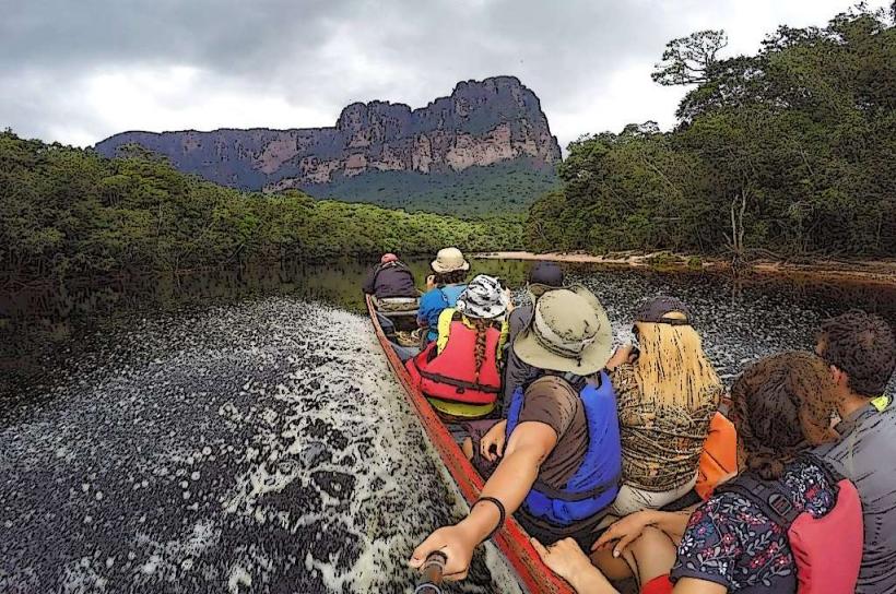
The Gran Sabana is situated in the Bolívar State of Venezuela, covering a significant portion of Canaima National Park. Access is primarily via the Troncal 10 highway, which runs through the region. The nearest major city is Ciudad Bolívar, approximately 600 km to the northwest. Access to specific points within the Gran Sabana often requires 4x4 vehicles due to unpaved and sometimes challenging road conditions. There are no direct public transport routes into the heart of the Gran Sabana; travel typically involves organized tours or private vehicle hire from cities like Santa Elena de Uairén, which is located at the southern end of the region near the Brazilian border.
Historical & Ecological Origin
The Gran Sabana's geological origins are tied to the ancient Guiana Shield, one of the oldest geological formations on Earth. The distinctive tepuis are erosional remnants of a sandstone plateau that has been uplifted and weathered over millions of years. Ecologically, the region represents a transition zone between the Amazon rainforest and the drier savannas of the north, supporting unique flora and fauna adapted to its specific environmental conditions.
Key Highlights & Activities
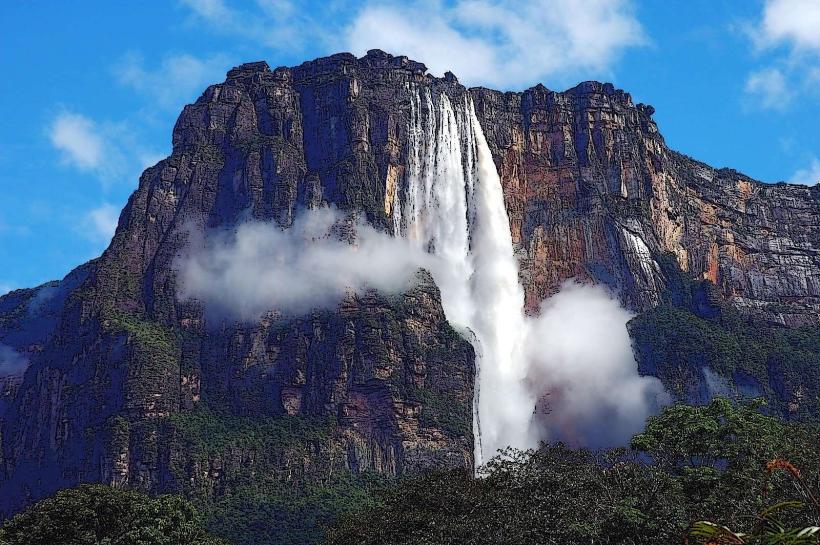
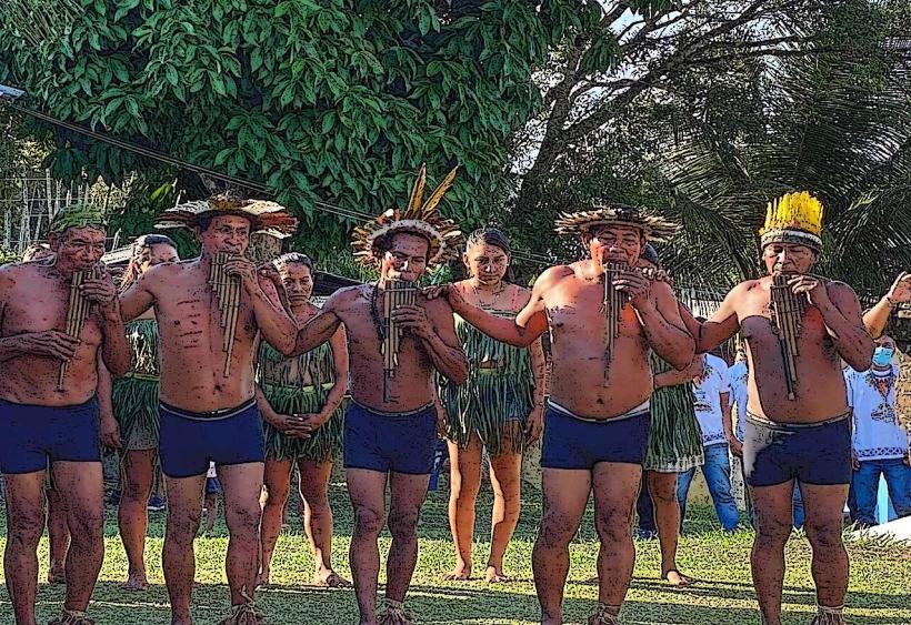
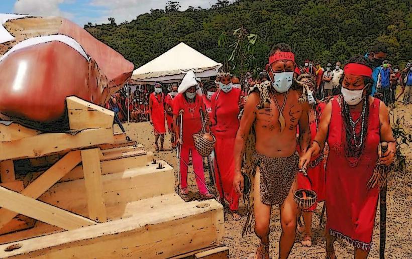
Activities include visiting waterfalls such as Salto El Ángel (Angel Falls), Salto Kama, and Salto Kawi. Hiking trails are available around some tepuis and waterfalls. Photography of the unique landscape and tepui formations is a primary activity. Birdwatching and wildlife observation are also possible. Visiting indigenous Pemón communities offers cultural insights.
Infrastructure & Amenities
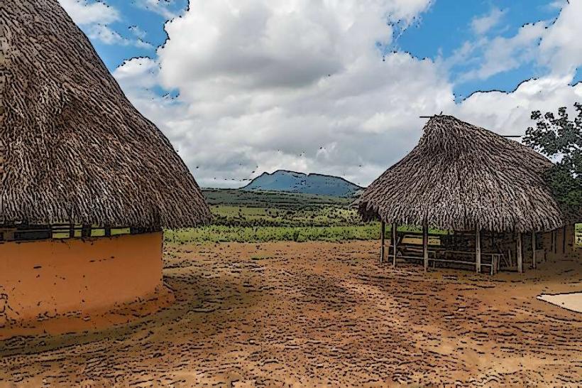
Basic infrastructure is present in settlements like Santa Elena de Uairén, including hotels, restaurants, and fuel stations. Within the national park, amenities are limited. Some tourist lodges offer accommodation and meals. Restrooms are generally available at established tourist sites and lodges. Cell phone signal is intermittent and often unavailable in remote areas. Shade is provided by vegetation and rock overhangs at specific locations.
Best Time to Visit
The dry season, from December to April, offers the most favorable conditions for travel, with clearer skies and lower river levels. The wet season, from May to November, can lead to higher river levels and potentially impassable roads. For photography, early morning and late afternoon provide optimal lighting for the tepui formations.
Facts & Legends
The tepuis are believed by the indigenous Pemón people to be the dwelling place of spirits. Local legends speak of the "Mawari," mischievous spirits that inhabit the region. A specific tip for visitors is to carry sufficient cash, as credit card facilities are rare outside of Santa Elena de Uairén.
Nearby Landmarks
- Salto El Ángel (Angel Falls) - 15km Northwest
- Canaima Lagoon - 40km Northwest
- Mount Roraima - 60km Southwest
- Kavak Caves - 30km South
- Uruyén - 25km Northwest