Information
Landmark: Río Auyán TepuyCity: Canaima National Park
Country: Venezuela
Continent: South America
Río Auyán Tepuy, Canaima National Park, Venezuela, South America
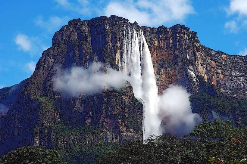
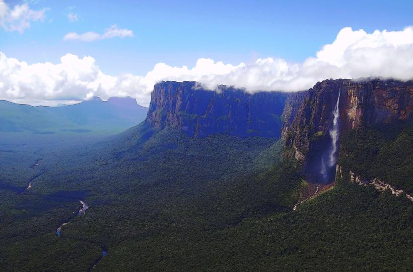
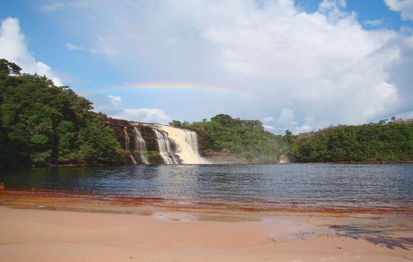
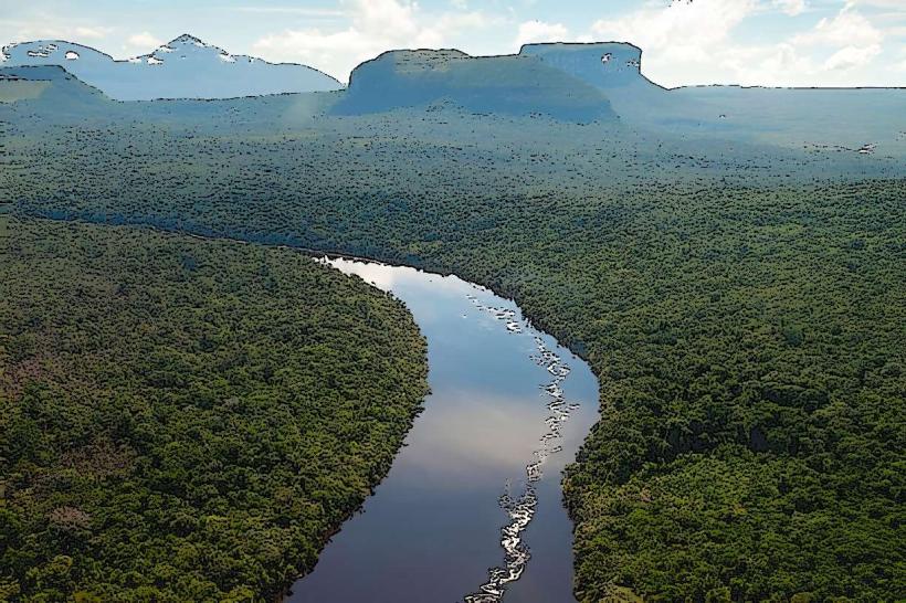
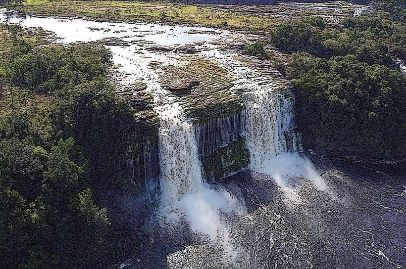
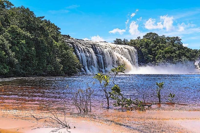
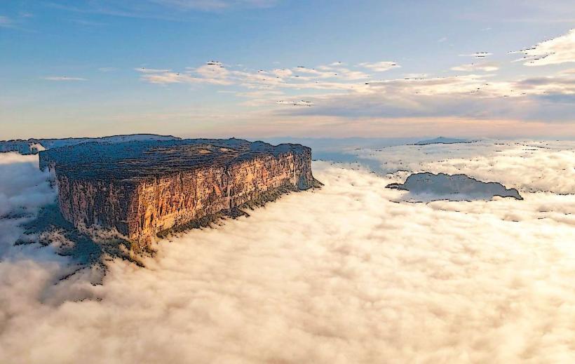
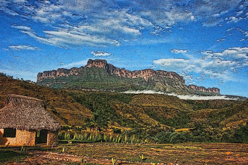
Río Auyán Tepuy is a large tabletop mountain located within Canaima National Park in Venezuela. It is the source of Angel Falls, the world's tallest uninterrupted waterfall.
Visual Characteristics
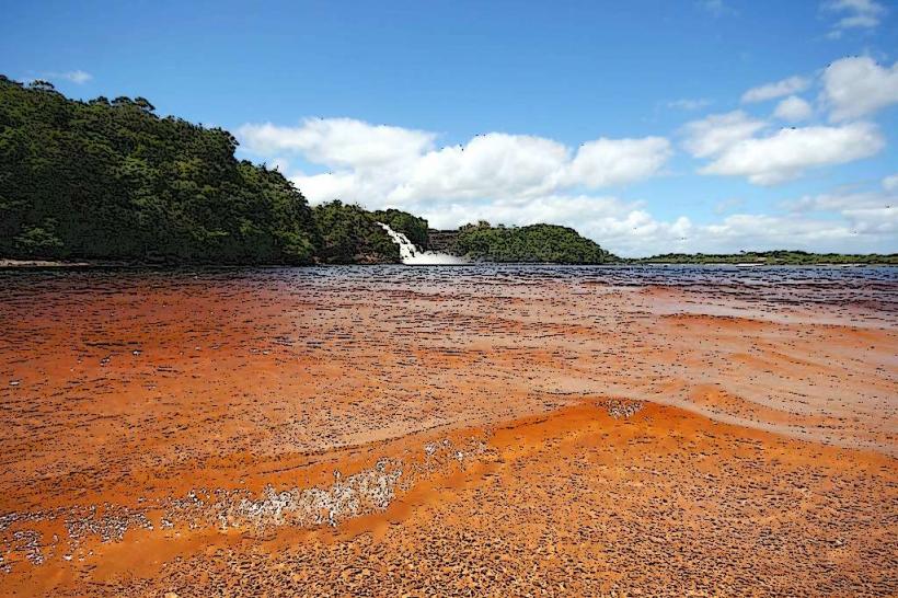
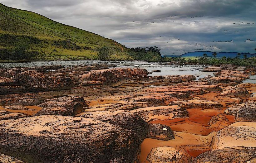
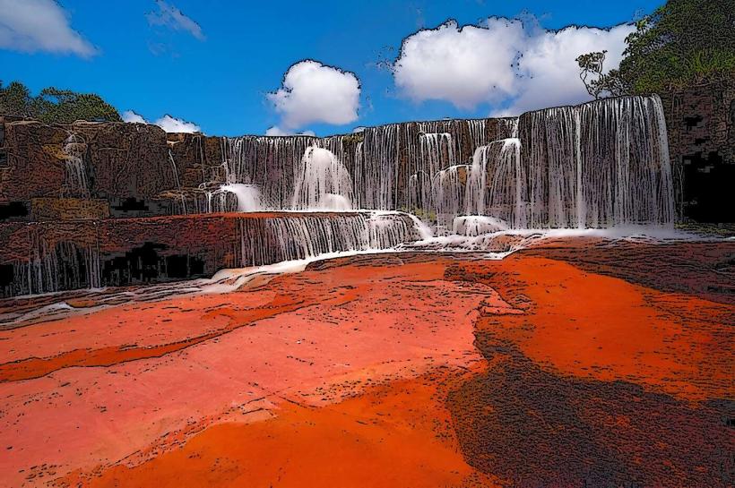
The tepuy is characterized by its flat summit, approximately 25 kilometers long and 12 kilometers wide, with sheer vertical cliffs dropping over 1,000 meters. The summit is composed of Precambrian quartzite sandstone. The exposed rock surfaces are predominantly grey to reddish-brown. Vegetation on the summit is sparse, consisting of low-lying shrubs, grasses, and carnivorous plants adapted to the nutrient-poor soil. The edges of the tepuy are marked by numerous small streams and cascades that converge to form the main waterfall.
Location & Access Logistics
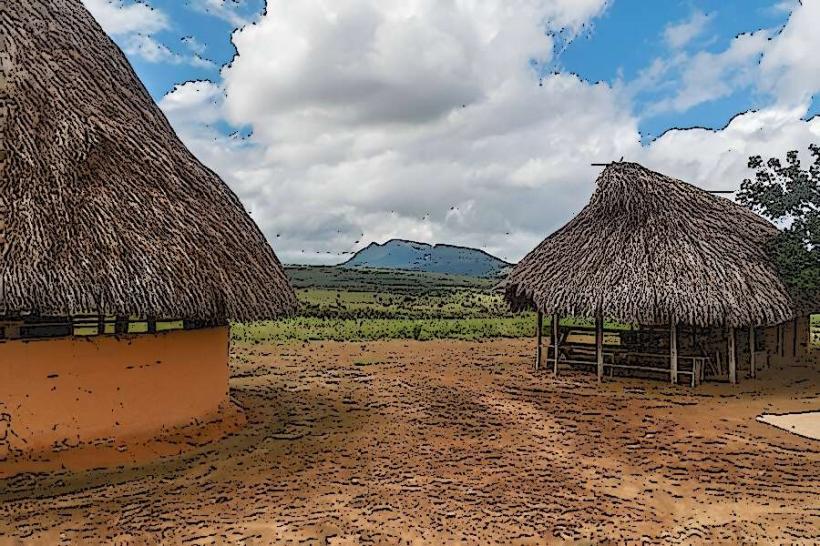
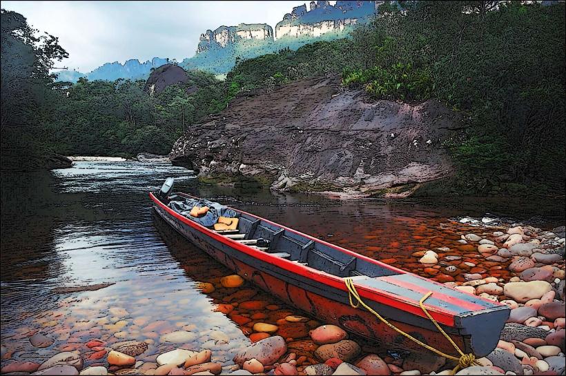
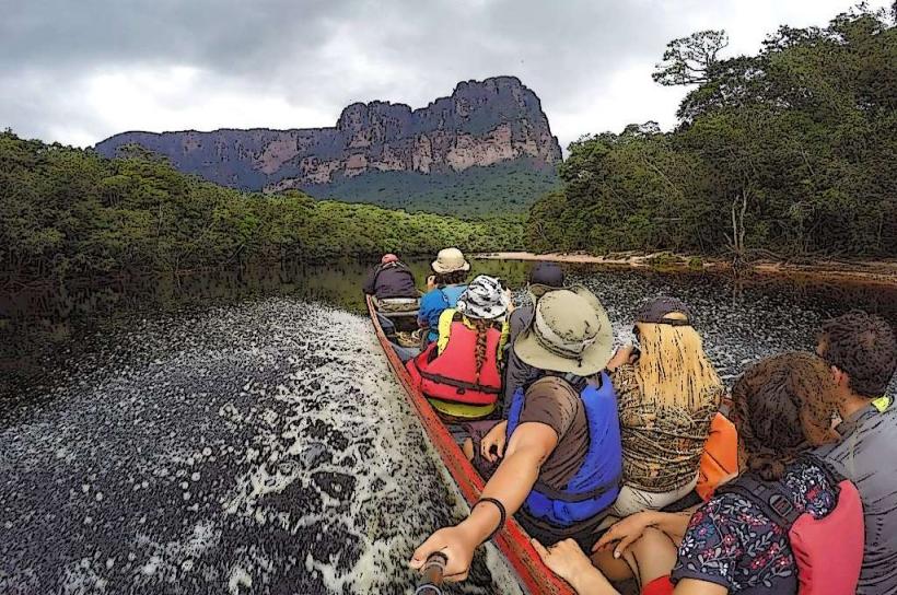
Río Auyán Tepuy is situated in the southeastern part of Canaima National Park, Bolívar State, Venezuela. Access is primarily via Canaima Camp, which is reachable by small aircraft from Puerto Ordaz or Ciudad Bolívar. From Canaima Camp, boat transfers up the Carrao and Churún rivers are required, followed by a hike through jungle terrain to the base of Angel Falls. The journey by boat typically takes 4-5 hours, and the hike to the viewpoint is approximately 1 hour. There is no road access to the tepuy itself.
Historical & Ecological Origin
Auyán Tepuy is a geological formation of Precambrian origin, part of the Guiana Shield. Its flat-topped structure, known as a tepuy, is the result of millions of years of erosion by wind and rain on ancient sandstone deposits. The sheer cliffs are a result of differential erosion, where harder sandstone layers resist weathering more than the underlying rock. The tepuy ecosystem is unique, supporting endemic species due to its isolation.
Key Highlights & Activities
The primary activity is viewing Angel Falls from the designated viewpoint at its base. Boat trips on the Churún River offer views of the tepuy's scale. Hiking is limited to the trail leading to the waterfall viewpoint. Camping is available at designated sites near the base of the falls.
Infrastructure & Amenities
Basic facilities are available at the viewpoint area, including a small shelter and designated camping spots. Restrooms are rudimentary. Food vendors are not present at the viewpoint; visitors typically bring their own provisions or arrange meals through tour operators in Canaima Camp. Cell phone signal is generally absent in the area of the tepuy and along the river.
Best Time to Visit
The best time to visit is during the rainy season, from May to November, when the water flow of Angel Falls is at its peak, creating a more dramatic spectacle. The dry season, from December to April, can result in a reduced flow. The best time of day for photography is mid-morning to early afternoon when sunlight can illuminate the falls, though direct sunlight can be harsh. High tide on the rivers is necessary for boat access.
Facts & Legends
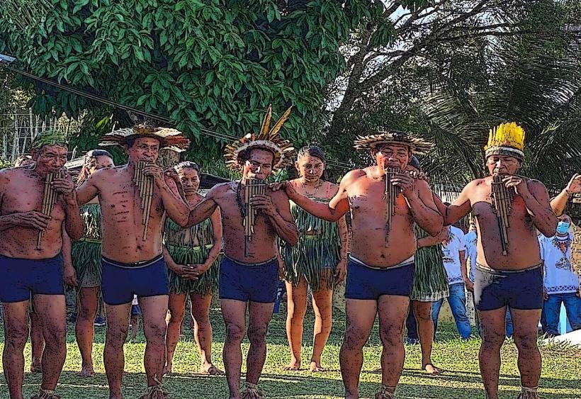
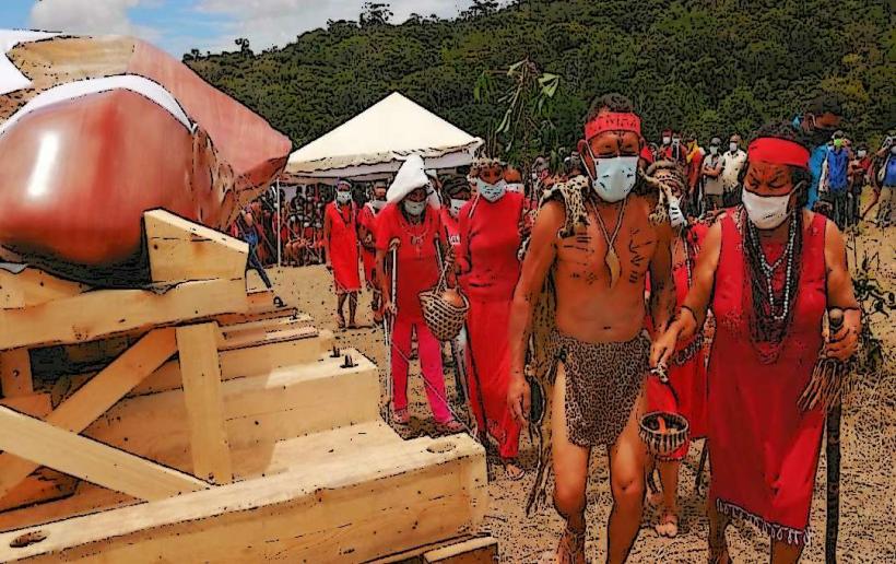
The indigenous Pemon people refer to Auyán Tepuy as "Auyán-tepuy," meaning "Mountain of the Devil." Local legends speak of spirits and mythical creatures inhabiting the tepuy. The first recorded flight over Angel Falls was by American aviator James Crawford Angel in 1933 while searching for gold.
Nearby Landmarks
- Canaima Camp (Approximately 50km Northwest)
- Sapo Falls (Approximately 50km Northwest)
- Hacha Falls (Approximately 50km Northwest)
- Uruyén Camp (Approximately 40km Northwest)