Information
City: La PalmaCountry: Canary Islands
Continent: Europe
La Palma, Canary Islands, Europe
La Palma, known as La Isla Bonita, is the northwesternmost of the Canary Islands. It is defined by its extreme verticality, lush laurel forests, and its status as a UNESCO Biosphere Reserve and Starlight Reserve. It is one of the steepest islands in the world relative to its surface area.
Historical Timeline
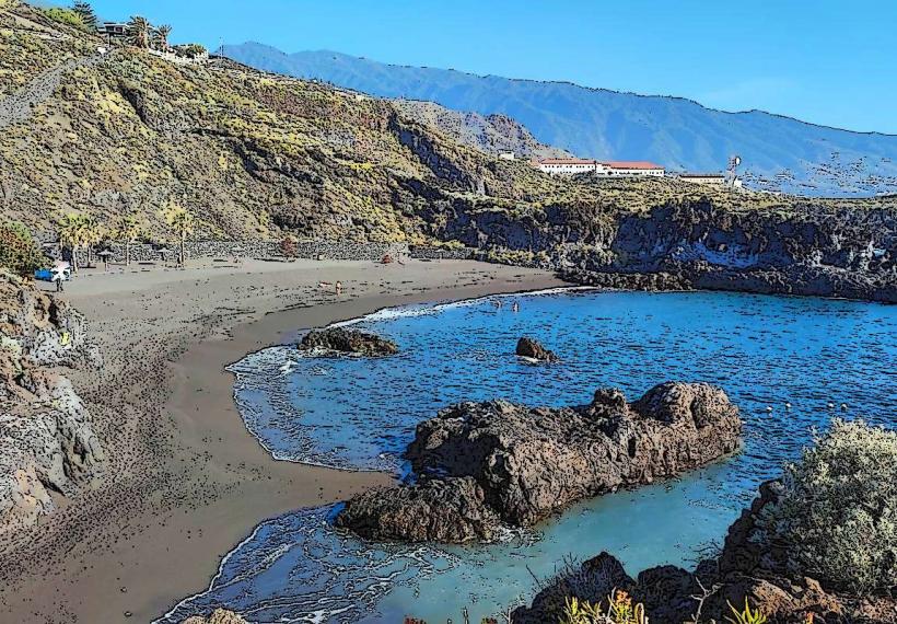
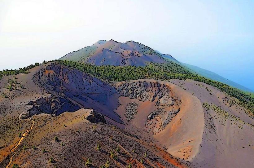
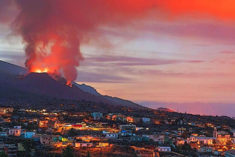
The island was originally inhabited by the Benahoarites. The Spanish conquest was completed in 1493 by Alonso Fernández de Lugo at the site of Santa Cruz de La Palma. During the 16th century, the island became the third most important port in the Spanish Empire (after Seville and Antwerp) due to sugar exports and its location on Atlantic trade routes. The primary event shaping its modern geography was the 2021 eruption of the Tajogaite volcano in the Cumbre Vieja ridge, which lasted 85 days and altered the southwestern coastline.
Demographics & Population
The population is approximately 83,500. Santa Cruz de La Palma (capital) and Los Llanos de Aridane are the two primary urban centers. The demographic is predominantly Spanish, with a smaller percentage of foreign residents compared to Tenerife or Gran Canaria, maintaining a more traditional local character.
Urban Layout & Key Districts
The island is divided by a central mountain ridge running north to south.
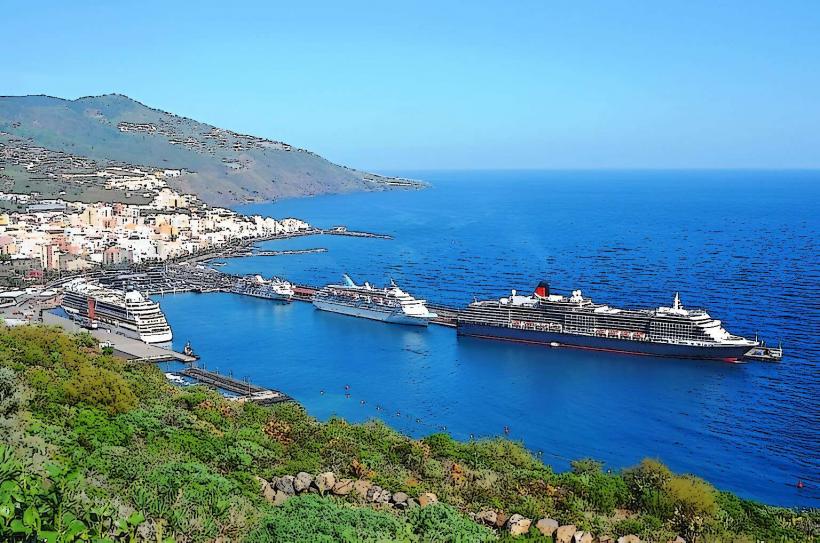
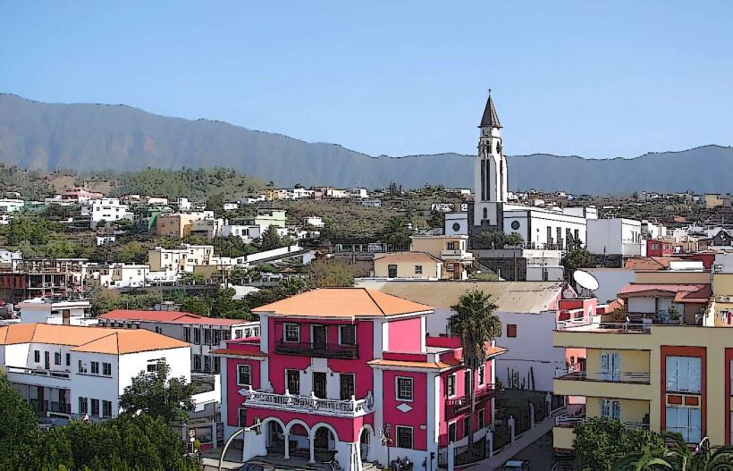
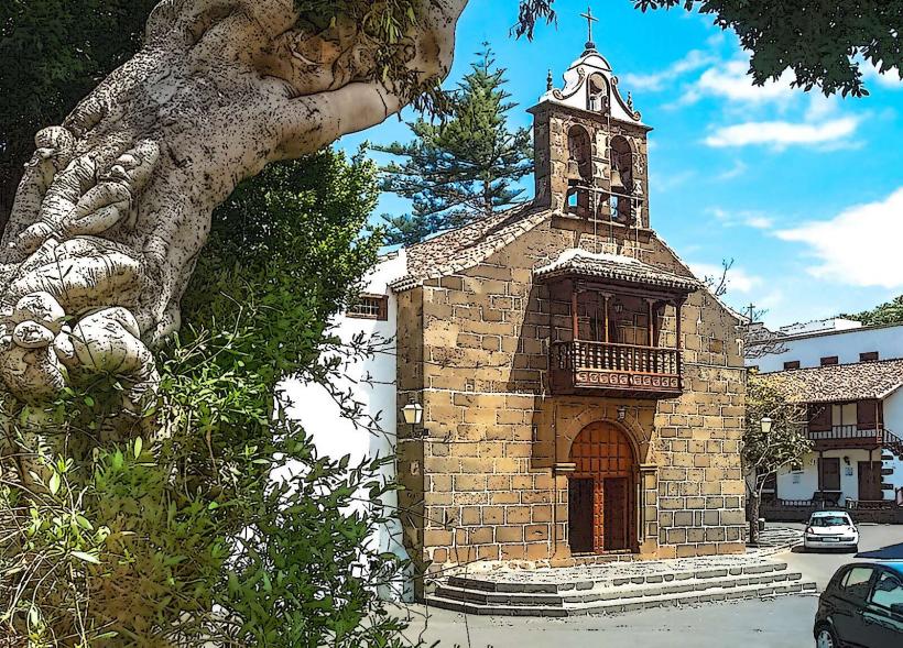
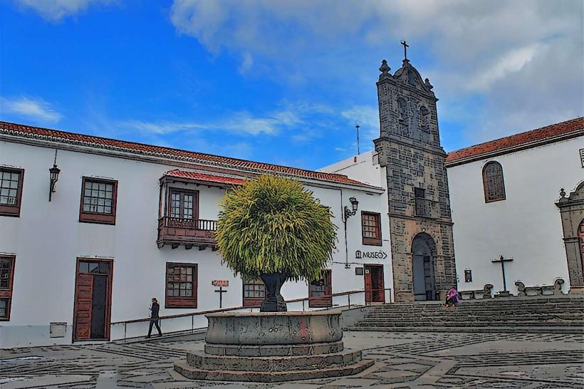
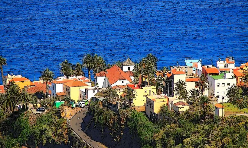
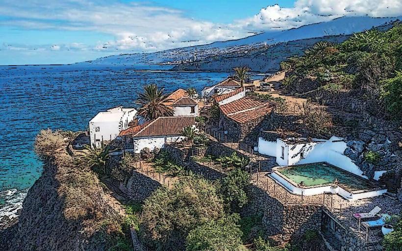
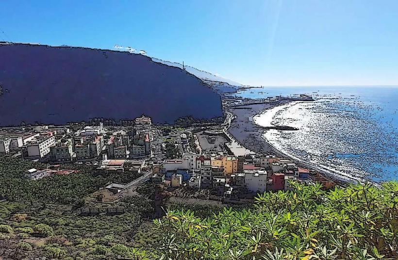
Santa Cruz de La Palma: The historic port capital on the east coast, famous for its colonial architecture and flower-adorned wooden balconies.
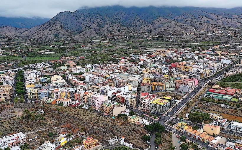
Los Llanos de Aridane: The commercial heart and largest city, located in the fertile Aridane Valley on the west side.
El Paso: The only landlocked municipality, situated at the entrance to the Caldera de Taburiente.
Fuencaliente: The southernmost district, dominated by recent volcanic activity and vineyards.
Top Landmarks
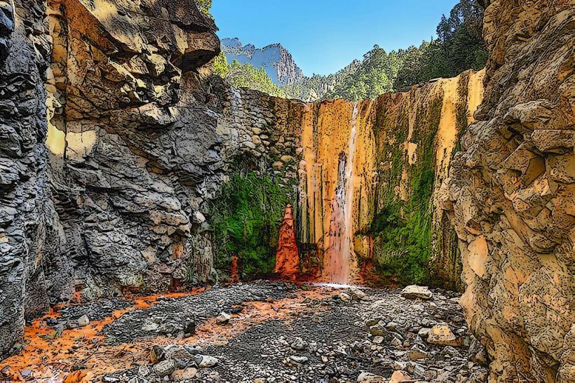
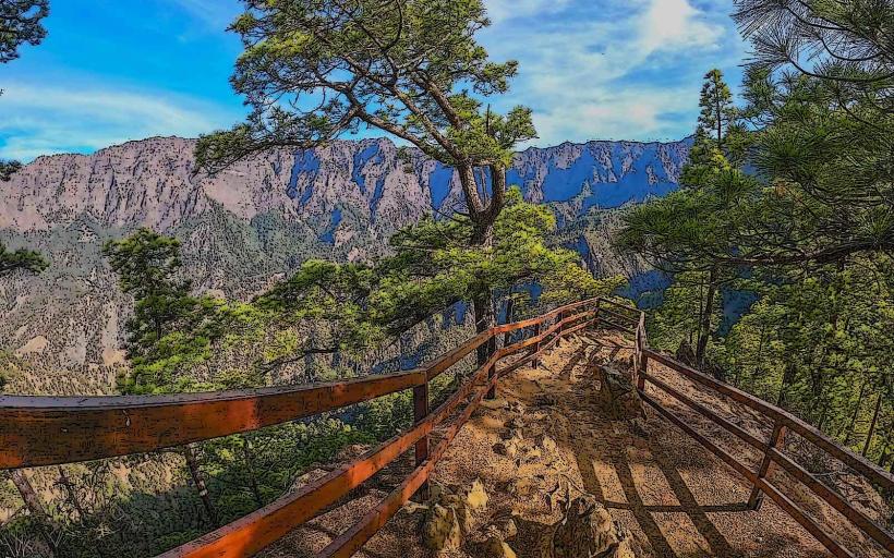
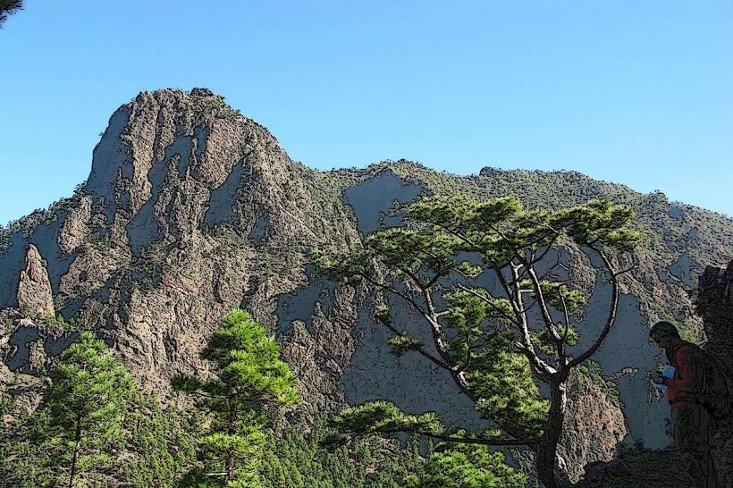
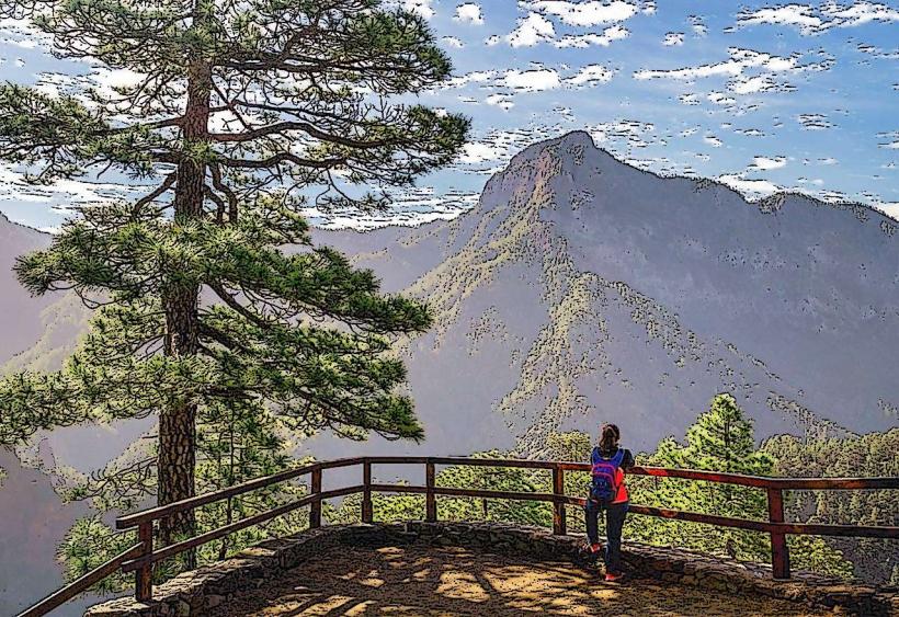
Caldera de Taburiente National Park: A massive erosional crater 8 km wide with walls rising 2,000 meters.
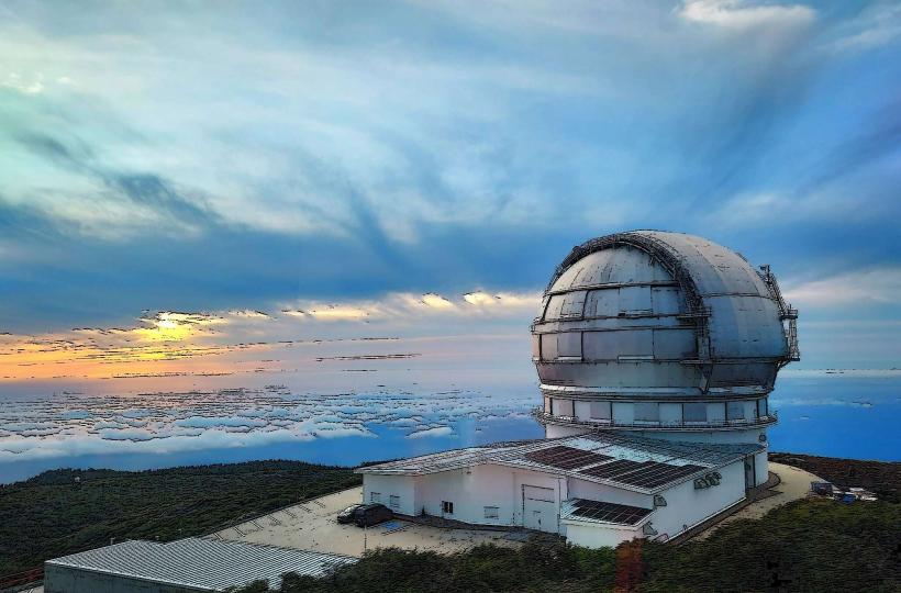
Roque de los Muchachos Observatory: Home to some of the world's most advanced telescopes, including the Gran Telescopio Canarias (GTC).
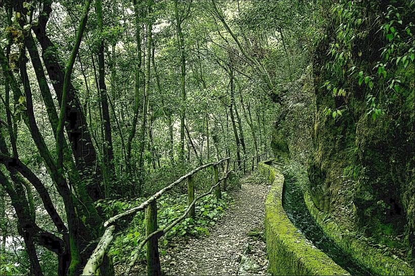
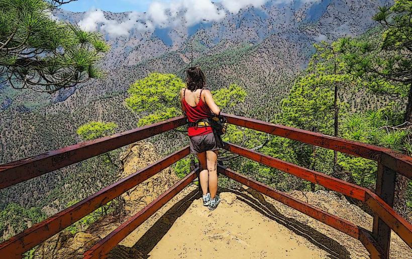
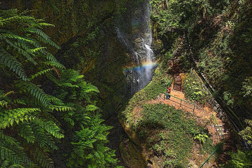
Los Tilos Forest: A prehistoric laurel forest (laurisilva) with high biodiversity and waterfall trails.
Salinas de Fuencaliente: Active salt pans located where the volcanic earth meets the Atlantic.
Cumbre Vieja Natural Park: The site of the island's most recent volcanic eruptions and the "Ruta de los Volcanes" hiking trail.
Transportation Network
Air: La Palma Airport (SPC) is located on the east coast, serving inter-island flights and direct European charters.
Roads: The LP-1 (North) and LP-2 (South) encircle the island. Driving is challenging due to extreme gradients and hundreds of hair-pin turns.
Public Transit: The Transportes Insular La Palma (green buses) network is reliable but slow due to topography.
Sea: Ferries connect Santa Cruz to Tenerife (2.5–4 hours) and La Gomera.
Safety & "Red Zones"
La Palma is extremely safe regarding crime. Environmental safety is the primary concern. Since the 2021 eruption, certain areas in the Puerto Naos and La Bombilla districts remain "Red Zones" with restricted access due to persistent volcanic gas emissions (CO2). Hiking trails can be hazardous during high winds or heavy rain; always check the senderos de La Palma status.
Digital & Financial Infrastructure
High-speed fiber is available in all major towns. Mobile coverage is excellent, even at high altitudes, though it can drop in deep ravines (barrancos). Card acceptance is near 100%. The currency is the Euro (€).
Climate & Air Quality
Microclimates: The east is humid and cloudier; the west is sunnier and warmer.
Astronomy: Due to the "Law of the Sky," light pollution is strictly regulated, providing some of the clearest air and darkest skies on Earth.
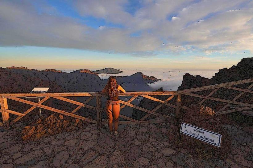
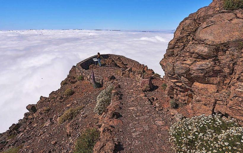
Sea of Clouds: A common phenomenon where trade winds create a layer of clouds at mid-altitude, leaving the peaks in permanent sunshine.
Culture & Social Norms
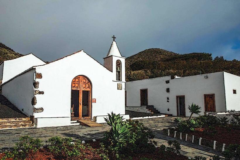
The culture is deeply rooted in agriculture (bananas and silk) and maritime history. Tipping is 5–10%. The Danza de los Enanos (Dance of the Dwarves) is the island's most famous cultural event, occurring every five years during the Bajada de la Virgen. "Palmerino" Spanish is noted for its distinctive, soft accent.
Accommodation Zones
Santa Cruz de La Palma: Best for history, dining, and transit access.
Los Cancajos: The primary tourist seaside resort on the east coast.
Tazacorte: Known for having the most sunshine hours and proximity to the new volcanic landscapes.
Local Cost Index
1 Espresso: €1.30 ($1.43)
1 Standard Lunch (Menù del Día): €11.00 ($12.10)
1 Kg of La Palma Bananas: €1.20 ($1.32)
Nearby Day Trips
Tenerife: 30-minute flight for major shopping or international connections.
La Gomera: Accessible via ferry for dense forest hiking.
Facts & Legends
A verified historical oddity is that Santa Cruz de La Palma was the first city in the Canary Islands (and the sixth in the world) to have electric street lighting, installed in 1893. Local legend speaks of "San Borondón," the vanishing island, which is most frequently "spotted" from the western cliffs of La Palma, appearing as a misty mountain on the horizon before disappearing.