Information
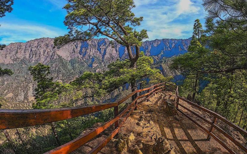
Landmark: La Cumbrecita ViewpointCity: La Palma
Country: Canary Islands
Continent: Europe
La Cumbrecita Viewpoint, La Palma, Canary Islands, Europe
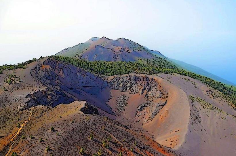
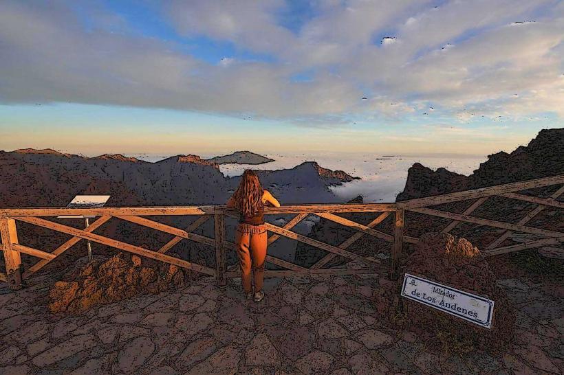
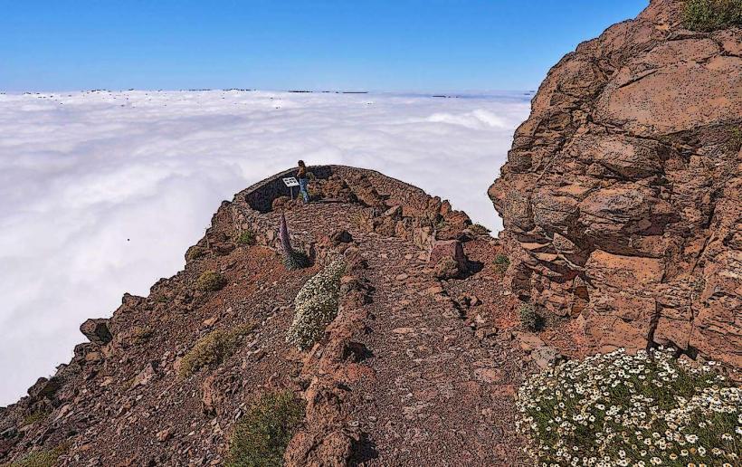
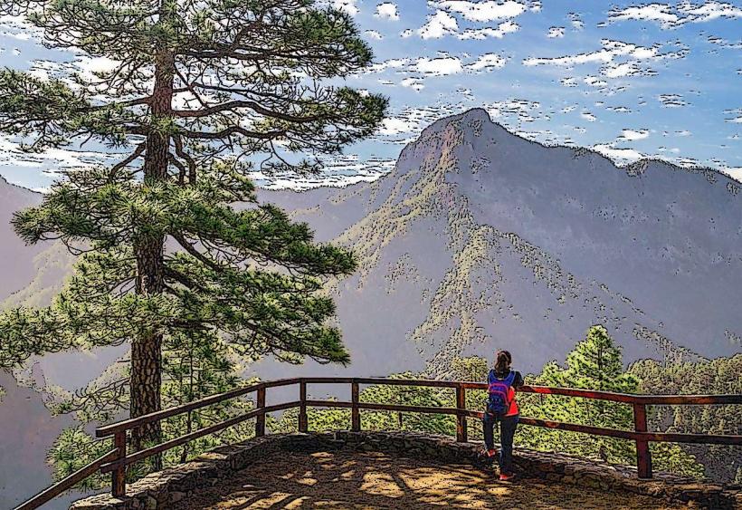
La Cumbrecita Viewpoint offers panoramic views into the Caldera de Taburiente National Park. It is located on the eastern rim of the caldera on the island of La Palma, Canary Islands.
Visual Characteristics
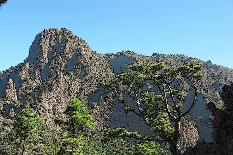
The viewpoint consists of a designated viewing platform, often with stone walls or railings, situated at an elevation of approximately 1,250 meters above sea level. The primary visual characteristic is the expansive view of the deep, erosion-formed caldera, characterized by steep, forested slopes of Canary Island pine, dark volcanic rock formations, and distant peaks such as Roque de los Muchachos.
Location & Access Logistics
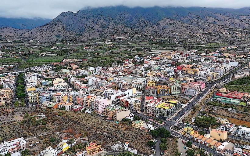
Access to La Cumbrecita Viewpoint is via the LP-301 road, which branches off the LP-3 near the town of El Paso. The viewpoint is approximately 12 kilometers from El Paso and 25 kilometers from Santa Cruz de La Palma. Parking is available but limited, and during peak seasons or times, a reservation for vehicle access is often required through the National Park's official website. There are no direct public transport routes to the viewpoint; a private vehicle is necessary.
Historical & Ecological Origin
The viewpoint is situated on the rim of the Caldera de Taburiente, a geological formation classified as a large erosion caldera. This caldera was formed by a combination of volcanic activity and subsequent extensive erosion over millions of years, rather than a single collapse. The surrounding ecosystem is dominated by endemic Canary Island pine forests (Pinus canariensis), adapted to volcanic soils and frequent cloud cover.
Key Highlights & Activities
The main activity is viewing the caldera and its surrounding peaks. Photography is a popular pursuit from the platform. Several hiking trails commence from or near La Cumbrecita, including the Sendero PR LP 13, which leads to Pico Bejenado, and the Sendero PR LP 13.1 to Mirador Lomo de las Chozas. These trails offer varying levels of difficulty and provide further perspectives of the caldera.
Infrastructure & Amenities
Restroom facilities are available near the parking area. The viewpoint itself offers limited natural shade, though the surrounding pine forests provide cover on hiking trails. Cell phone signal (4G/5G) is generally available due to the elevation. There are no food vendors or shops directly at the viewpoint; the nearest services are in El Paso.
Best Time to Visit
The best time to visit for clear views is typically in the morning, before clouds often roll in and obscure the caldera. The months of April to June and September to November generally offer the most stable weather conditions. During winter, temperatures can be low, and occasional snow or ice may affect access. Summer can be warm, but the elevation provides some relief.
Facts & Legends
The Caldera de Taburiente is one of the largest erosion calderas globally, with a diameter of approximately 10 kilometers and walls rising up to 2,000 meters. A practical tip for visitors is to always check the weather forecast for the high altitudes before planning a trip, as conditions can differ significantly from coastal areas. Access to the viewpoint's parking area is often regulated, requiring prior booking, especially during peak tourist seasons.
Nearby Landmarks
- Mirador Lomo de las Chozas: 0.5km East (via hiking trail)
- Pico Bejenado: 3km South (via hiking trail PR LP 13)
- Caldera de Taburiente National Park Entrance (for trails into the caldera): 1km West (via hiking trail)