Information
Landmark: Central CanalCity: Bhairahawa
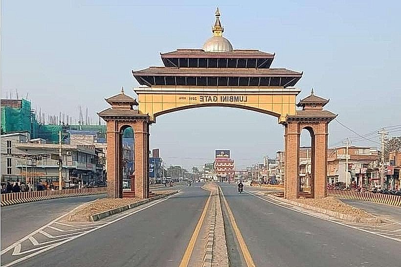
Country: Nepal
Continent: Asia
Central Canal, Bhairahawa, Nepal, Asia
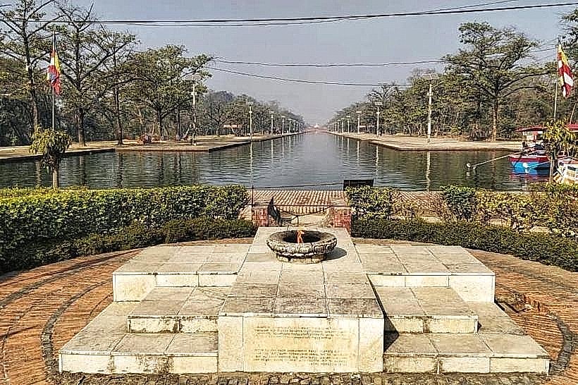
The Central Canal is a 1.4-kilometer-long waterway that serves as the primary longitudinal axis of the Lumbini Master Plan in Nepal. Designed by Japanese architect Kenzo Tange, it functions as both a symbolic and literal "Central Link" connecting the various zones of the sacred site.
Visual Characteristics
The canal is a straight, narrow water channel characterized by its symmetry and clear geometric lines. It is flanked on both sides by wide brick-paved walkways and rows of planted trees, primarily Ashoka and Sal trees. The water is typically calm, reflecting the surrounding greenery and the white structures of the nearby monasteries. Several arched brick bridges cross the canal at regular intervals, connecting the East and West Monastic Zones.
Location & Access Logistics
The canal runs north-south through the heart of the Monastic Zone.
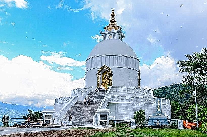
North End: Connects to the New Lumbini Village and the World Peace Pagoda.
South End: Terminates near the Eternal Peace Flame, which acts as the gateway to the Sacred Garden (Maya Devi Temple).
Transport: Visitors can traverse the canal via outboard motorboats (operated by the Lumbini Development Trust) for a small fee. It is also the primary route for those exploring on foot or by bicycle.
Historical & Ecological Origin
The canal was conceptualized as part of the 1978 Kenzo Tange Master Plan, commissioned by the United Nations and the Government of Nepal. Architecturally, it represents the "Path to Enlightenment," leading pilgrims from the "worldly" activities of the North Village through the "spiritual" Monastic Zone toward the "enlightenment" of the Sacred Garden. Environmentally, the canal helps manage the high water table of the Terai plains and provides a cooling effect during the extreme summer heat.
Key Highlights & Activities
Boat Rides: A popular activity for tourists to transit between the northern and southern sections of the park while viewing the international monasteries from the water.
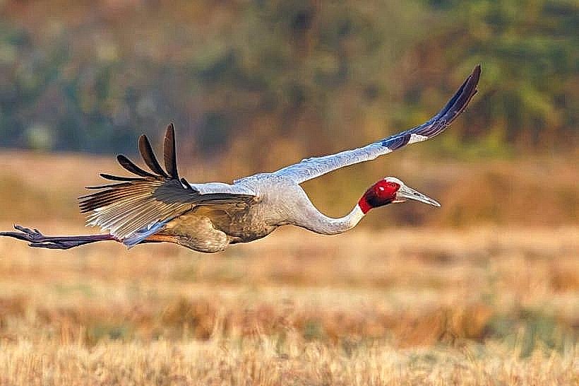
Birdwatching: The quiet banks of the canal are frequented by local waterfowl and occasionally Sarus Cranes from the nearby sanctuary.
Photography: The canal offers one of the most iconic perspectives of Lumbini, with the World Peace Pagoda visible at its northern terminus.
Infrastructure & Amenities
The canal's walkways are equipped with stone benches and shaded rest areas. While the canal itself is a transit corridor, the bridges serve as connection points to the East (Theravada) and West (Mahayana) Monastic Enclaves, where more comprehensive facilities are located. 4G/5G mobile signals are consistently strong along the entire length of the canal.
Best Time to Visit
The best time to experience the canal is during the early morning (06:30–08:30) or late afternoon (16:00–18:00). During these hours, the heat is manageable, the wind is minimal (allowing for mirror-like reflections on the water), and the boat traffic is less dense.
Facts & Legends
A verified architectural detail is that the canal is designed to be exactly 1.4km long to maintain the mathematical proportions of the 1x3 mile Master Plan. Symbolically, the canal is often likened to a "river of transition," separating the different sects of Buddhism while simultaneously uniting them through the bridges that span its width.
Nearby Landmarks
Eternal Peace Flame (South Terminus)
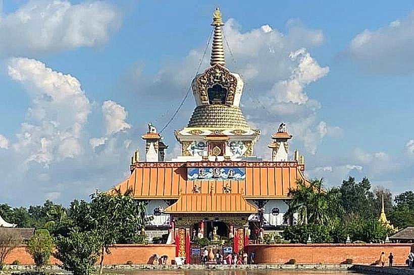
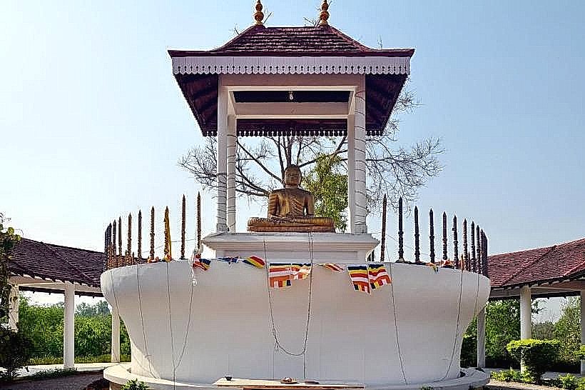
World Peace Pagoda (North Terminus)
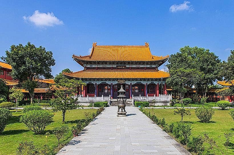
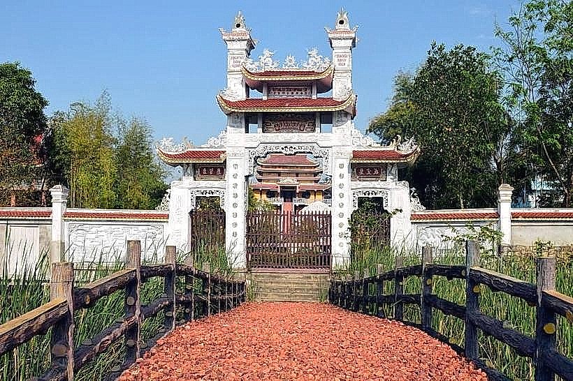
Zhong Hua Chinese Monastery (Central, West Side)
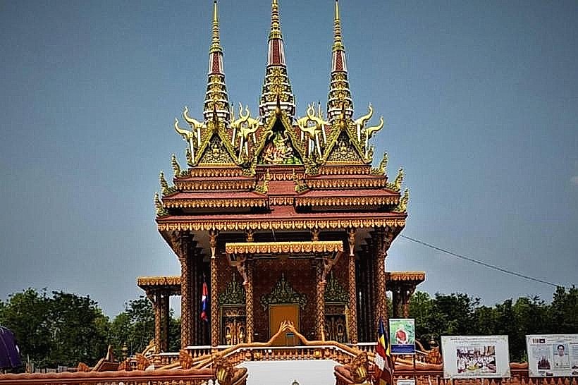
Royal Thai Monastery (Central, East Side)
Lumbini Museum (Northeast Edge)